


In recent years, the advancement of LiDAR systems and 3D scanning technology has revolutionized several industries by providing highly accurate, high-resolution data and models. LiDAR, which stands for Light Detection and Ranging, utilizes laser light to measure distances and generate detailed maps and models. As we look to the future, it’s clear that innovations in this realm, such as mobile LiDAR, drone-based scanning, and AI-powered point cloud analysis, are set to transform how industries operate, offering unprecedented levels of detail and efficiency.
LiDAR: The Foundation of Reality Capture
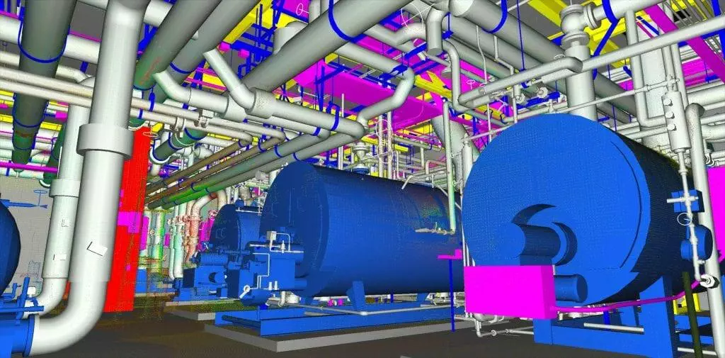
At the core of reality capture technologies are LiDAR sensors, which emit laser light to perform distance measurements with remarkable precision. This technology produces point cloud data-a collection of data points in space that can be used to generate 3D models and lidar maps. These 3D point clouds are foundational in producing digital elevation models (DEMs) and other structural representations that are critical for numerous applications.
LiDAR scanning provides an unparalleled advantage in capturing high-resolution details of environments, enabling professionals across various fields to make more informed decisions. The use of laser scanners combined with inertial measurement units (IMUs) helps to create accurate and reliable data sets that capture every nuance of the scanned environment.
Emerging Trends in LiDAR and 3D Scanning
Mobile LiDAR
One of the most significant developments in the field is mobile LiDAR, which integrates lidar sensors with moving platforms, such as vehicles or handheld devices. This allows for the rapid collection of data over extensive areas without the need for stationary setups. Mobile LiDAR is particularly beneficial for industries like transportation, where it can be used to assess infrastructure and road conditions in real-time. This application not only increases efficiency but also enhances safety by minimizing the need for manual inspections in potentially hazardous locations.
Drone-Based Scanning
Drone-based scanning has emerged as a game-changer, making it possible to access areas that are otherwise difficult or dangerous to reach. By using drones equipped with lidar light detection technology, industries such as agriculture, forestry, and mining can monitor vast expanses of land quickly and cost-effectively. The ability to capture aerial views and create detailed lidar maps provides stakeholders with valuable insights into terrain and environmental conditions, driving strategic decision-making and resource management.
AI-Powered Point Cloud Analysis
As the volume of collected point cloud data grows, the integration of artificial intelligence is becoming essential for efficient analysis and interpretation. AI-powered algorithms can automatically classify and segment 3D point clouds, distinguish patterns, and even detect anomalies. This capability significantly speeds up the analysis process and reduces human error, empowering industries to leverage lidar maps and 3D models with greater accuracy.
Integration with Digital Twins
Reality capture technologies are increasingly intertwined with the development of digital twins-virtual replicas of physical entities that can be used for simulation, analysis, and optimization. By incorporating LiDAR scans and 3D scanning into digital twins, organizations can achieve a more comprehensive understanding of their assets’ current conditions. This integration enables predictive maintenance, enhanced design processes, and informed decision-making, which ultimately lead to reduced costs and improved operational efficiency.
Industry Implications and Future Possibilities
Construction and Architecture
In the construction and architecture sectors, LiDAR scanning allows for accurate as-built documentation and real-time progress tracking. With high-resolution 3D point clouds, architects and engineers can visualize projects more effectively, reducing the likelihood of costly errors and rework. The technology also facilitates compliance with building regulations and supports sustainable design by providing precise data for energy-efficient construction.
Environmental Monitoring
For environmental scientists and conservationists, lidar sensors provide a powerful tool for monitoring changes in ecosystems, assessing natural resources, and evaluating the impact of human activities. The ability to generate detailed digital elevation models supports habitat mapping, forest inventory, and flood risk assessment, among other applications.
Urban Planning and Infrastructure
Urban planners benefit from LiDAR and 3D scanning by gaining insights into existing infrastructure and identifying opportunities for development. Accurate lidar maps enable planners to model urban environments, optimize traffic flow, and enhance public safety. As cities pursue smart city initiatives, the integration of reality capture technologies will be pivotal in creating sustainable, resilient urban landscapes.
The future of reality capture is being shaped by the continued evolution of LiDAR systems and 3D scanning technologies. As these tools become increasingly sophisticated and accessible, industries across the board stand to benefit from enhanced data accuracy, improved efficiency, and new capabilities. By embracing innovations such as mobile LiDAR, drone-based scanning, and AI-powered analysis, organizations can unlock the full potential of reality capture, driving progress and transformation in an ever-evolving landscape. Darling Geomatics is at the forefront of these advancements, ready to lead the charge into this promising future.