Blog
UAV Thermal Imaging: Fast, Safe Building Envelope Analysis for Factories and Commercial Buildings
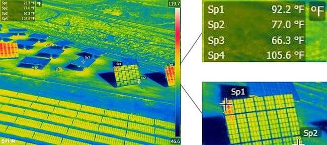
UAV Thermal Imaging: Fast, Safe Building Envelope Analysis for Factories and Commercial Buildings Building owners face a persistent challenge. Energy costs consume substantial operational budgets while aging building envelopes deteriorate invisibly behind walls and above ceilings. Traditional inspection methods require scaffolding, building access equipment, and production shutdowns that cost more than the inspections themselves. Meanwhile,…
Read MoreMetrology in Industrial Facilities: Ensuring Precision for Factories and Manufacturing Plants

Metrology in Industrial Facilities: Ensuring Precision for Factories and Manufacturing Plants Modern manufacturing success depends on measurement precision measured in microns. A single misaligned component can halt production lines for hours. Dimensional deviations of millimeters cascade into quality failures costing thousands in scrap and rework. In this environment, industrial metrology has evolved from occasional verification…
Read MoreCreating Accurate Digital Twins with LiDAR Scanning: A Step-by-Step Guide
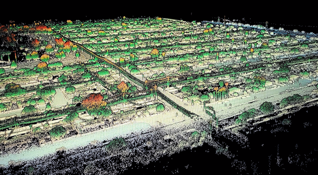
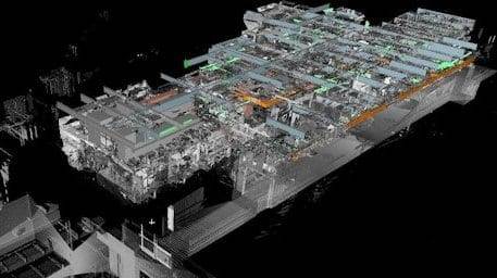
Creating Accurate Digital Twins with LiDAR Scanning: A Step-by-Step Guide A digital twin is more than a 3D model. It’s a living, data-rich replica of a physical asset that supports real-time decision-making, predictive maintenance, and operational planning. The foundation of any useful digital twin is accurate geometry, and that’s where LiDAR scanning comes in. LiDAR…
Read MoreWhat are reality capture and digital twins anyway?
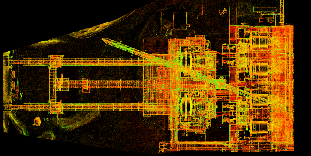
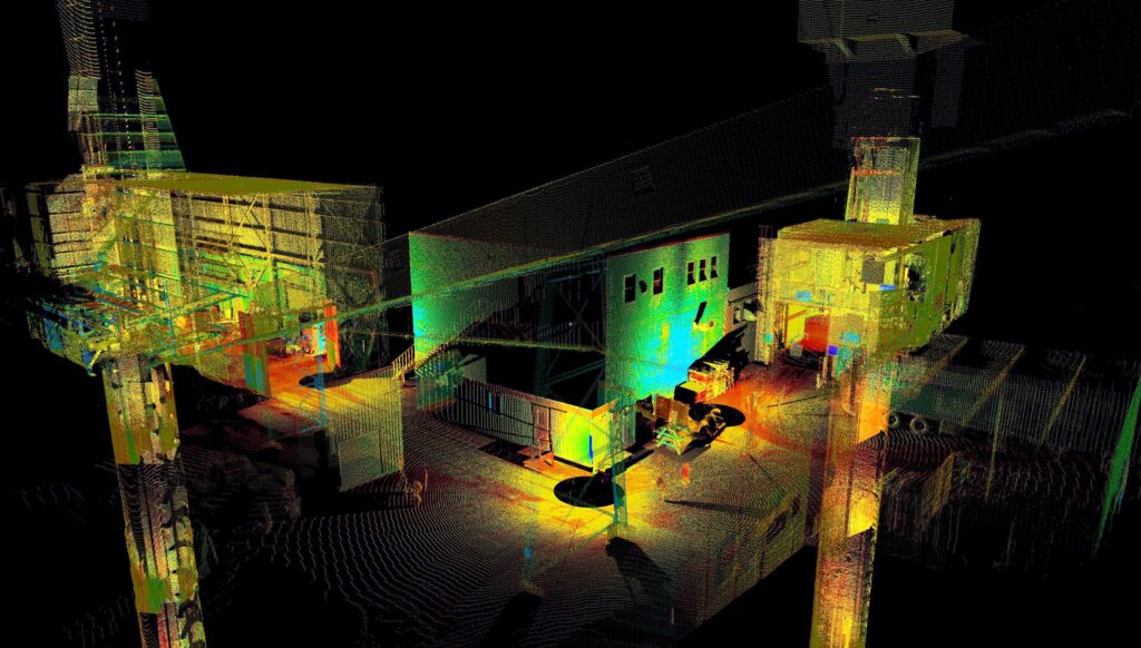
What are reality capture and digital twins anyway? If you’ve been in manufacturing project management for more than a few months lately, you’ve probably heard someone mention reality capture or digital twins in a meeting. Maybe it was during a facility expansion discussion, or when someone was trying to solve a clash detection problem. These…
Read MoreTop 7 Benefits of Using Drones for Land Surveys – Speed, Savings and Superior Data
Top 7 Benefits of Using Drones for Land Surveys – Speed, Savings and Superior Data The land surveying industry has changed dramatically over the past decade. What used to take weeks of manual fieldwork can now be accomplished in a matter of hours. Drone surveying has emerged as a game-changer for professionals who need accurate,…
Read MoreWhen Is an As-Built Survey Needed? Complete Requirements Guide
When Is an As-Built Survey Needed? Complete Requirements Guide Construction projects rarely go exactly as planned. Regulations change, lenders impose new requirements, and municipalities demand documentation you never saw coming. Understanding when an as-built survey becomes necessary can save your project from costly delays and compliance issues. At Darling Geomatics, we see the same question…
Read More3D Scanning Services That Redefine Accuracy: How Darling Geomatics Captures Every Detail
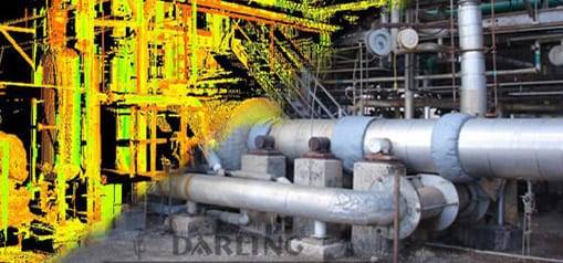
3D Scanning Services That Redefine Accuracy: How Darling Geomatics Captures Every Detail 3D scanning has transformed the way projects are planned, designed, and built. Instead of relying on limited measurements and drawings, engineers, architects, and developers now have access to highly detailed digital models that mirror reality. At Darling Geomatics, our 3D scanning services deliver…
Read MoreDarling Geomatics Awarded On-Call Land Surveying Contract for the City of Tucson
Darling Geomatics Awarded On-Call Land Surveying Contract for the City of Tucson Tucson Continues to Grow Darling Geomatics is proud to announce that we have been awarded the 2025-2026 on-call land surveying contract for the City of Tucson. This award highlights our decades of experience, dedication to precision and safety, and commitment to supporting the…
Read MoreLiving Blueprints: Why 2025 Is the Breakout Year for Digital Twins
Living Blueprints: Why 2025 Is the Breakout Year for Digital Twins For years, the concept of a digital twin sounded futuristic: something reserved for aerospace labs or advanced manufacturing plants. But in 2025, that’s changed. Digital twin technology is rapidly becoming essential for construction sites and industrial property management. Today’s digital replicas are more than…
Read MoreTop FAQs About Drone Surveying – Darling Geomatics

Drone Surveying FAQs: Everything You’ve Wanted to Ask (But Didn’t Know Who to Ask) Drone surveying is revolutionizing the world of geospatial data collection, but for many engineers, developers, and project managers, it remains a mystery. In this blog, we tackle the most frequently asked questions about drone surveying — the ones people hesitate to…
Read More