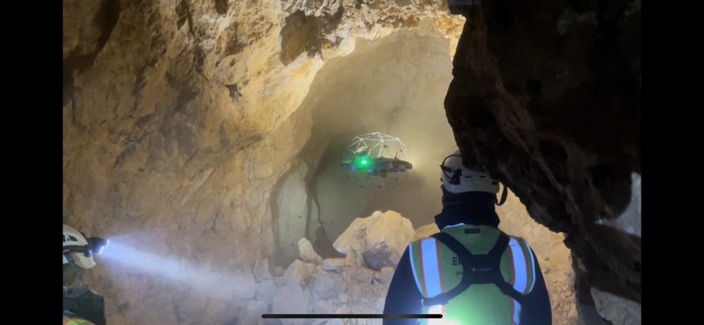
The evolution of underground mapping technology has transformed how we understand and navigate complex mine networks. Through the integration of LiDAR (Light Detection and Ranging) technology, geological surveys have reached unprecedented levels of accuracy and detail, revolutionizing how we approach underground mine mapping projects.
The Power of Precision
Modern LiDAR systems can capture millions of data points per second, creating highly detailed 3D representations of underground spaces. This level of precision is crucial for:
- Safety assessment and planning
- Resource extraction optimization
- Structural stability monitoring
- Environmental impact evaluation
- Emergency response preparation
Interactive Mapping: A Game-Changer
Today’s mining operations benefit from interactive mapping capabilities that allow engineers and geologists to:
- Visualize complex geological structures in real-time
- Navigate through virtual mine representations
- Identify potential hazards before they become problems
- Plan efficient extraction routes
- Monitor changes in mine conditions over time
Integration with Natural Resources Management
The Office of Surface Mining and other regulatory bodies increasingly rely on LiDAR data to:
- Assess environmental impact
- Monitor compliance with safety regulations
- Track resource extraction progress
- Plan rehabilitation efforts
- Document historical mining activities
Advanced Applications in Complex Networks
Modern underground mine mapping projects utilize LiDAR technology to:
Create Digital Twins
- Accurate to within centimeters or millimeters
- Updated in real-time
- Accessible from anywhere
- Shareable across teams
- Useful for training and planning
Monitor Structural Integrity
- Detect subtle changes in tunnel geometry
- Identify potential weak points
- Track ground movement
- Assess support system effectiveness
- Predict maintenance needs
Optimize Resource Extraction
- Map ore body locations precisely
- Plan efficient extraction routes
- Minimize waste
- Reduce environmental impact
- Maximize resource recovery
Enhance Safety Protocols
- Identify escape routes
- Plan emergency responses
- Train personnel virtually
- Document hazardous areas
- Monitor ventilation systems
The Future of Underground Mapping
As technology continues to advance, we’re seeing new applications emerge:
- Integration with AI for predictive analysis
- Real-time updating of geological models
- Automated hazard detection
- Enhanced visualization tools
- Remote operation capabilities
Challenges and Solutions
While LiDAR technology offers tremendous benefits, implementing it in underground environments presents unique challenges:
- Data management
- Processing massive datasets
- Data storage solutions
- Access in remote locations
- Data security
- Integration with existing systems
- Environmental factors
- Dust and moisture management
- Equipment durability
- Power supply considerations
- Communication infrastructure
- Temperature variations
The integration of LiDAR technology in underground mine mapping represents a significant leap forward in our ability to understand and manage complex mine networks. By combining precise measurement capabilities with interactive mapping tools, we’re better equipped than ever to extract natural resources safely and efficiently while maintaining environmental responsibility.
As we continue to push the boundaries of what’s possible in underground mapping, the future holds exciting possibilities for even more advanced applications of this technology. From improved safety protocols to more efficient resource extraction, LiDAR is helping shape the future of mining operations worldwide.
For those involved in mining operations or geological surveys, staying current with these technological advances is crucial for maintaining competitive advantage and ensuring optimal safety and efficiency in underground operations.

