To meet the rising global market demand for minerals, rare earth elements and other precious metal deposits, mines around the world are taking a closer look at their inactive underground workings for potential re-mining. By combining new methodologies of mineral extraction, improved safety infrastructure techniques and the technological advancements in 3D surveying and mine mapping, mines now have the tools necessary to evaluate bringing inactive workings back into operation.
With the goal to re-open, an inactive Nevada gold mine needed accurate 3D maps of the underground workings — that had been dormant for over 25 years. With personnel safety a top concern before operations could be restarted, they looked to a partner who could safely and accurately capture the critical data for their operational and safety assessments. Darling Geomatics built a customized inspection plan using LiDAR on their state-of-the-art aerial drones and ground-based equipment, and within days, Darling crews were able to capture, create and deliver georeferenced highly detailed 3D as-built models.
- Captured top geometry of mining shaft. This was a critical component of the project, as it allowed Darling crews to tie all data to survey control at the surface.
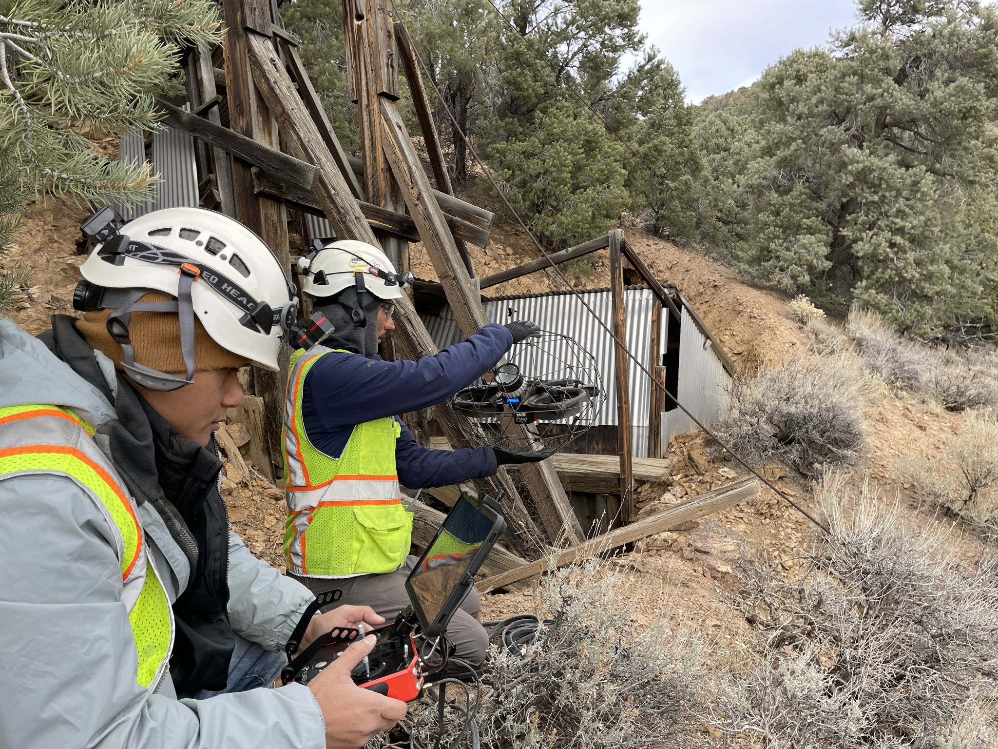
- Multiple crews deployed to execute several surveys. Three 2-person crews were deployed, each crew focused on one of the following: the surface survey element, the surface and underground laser scanning element, and the surface and underground drone work.
- Used both ground and drone LiDAR to compile a complete, combined measurable image of the workings. Meeting the client’s requirements, the final deliverable used the same mine coordinate system to facilitate design engineering of future upgrades.
Project Facts
Project: Map underground mine workings to assess for safety, return to operations
Client: Gold mine (inactive)
Project Location: Nevada, US
Industry: Mining
Applications: 3D Tunnel Scanning
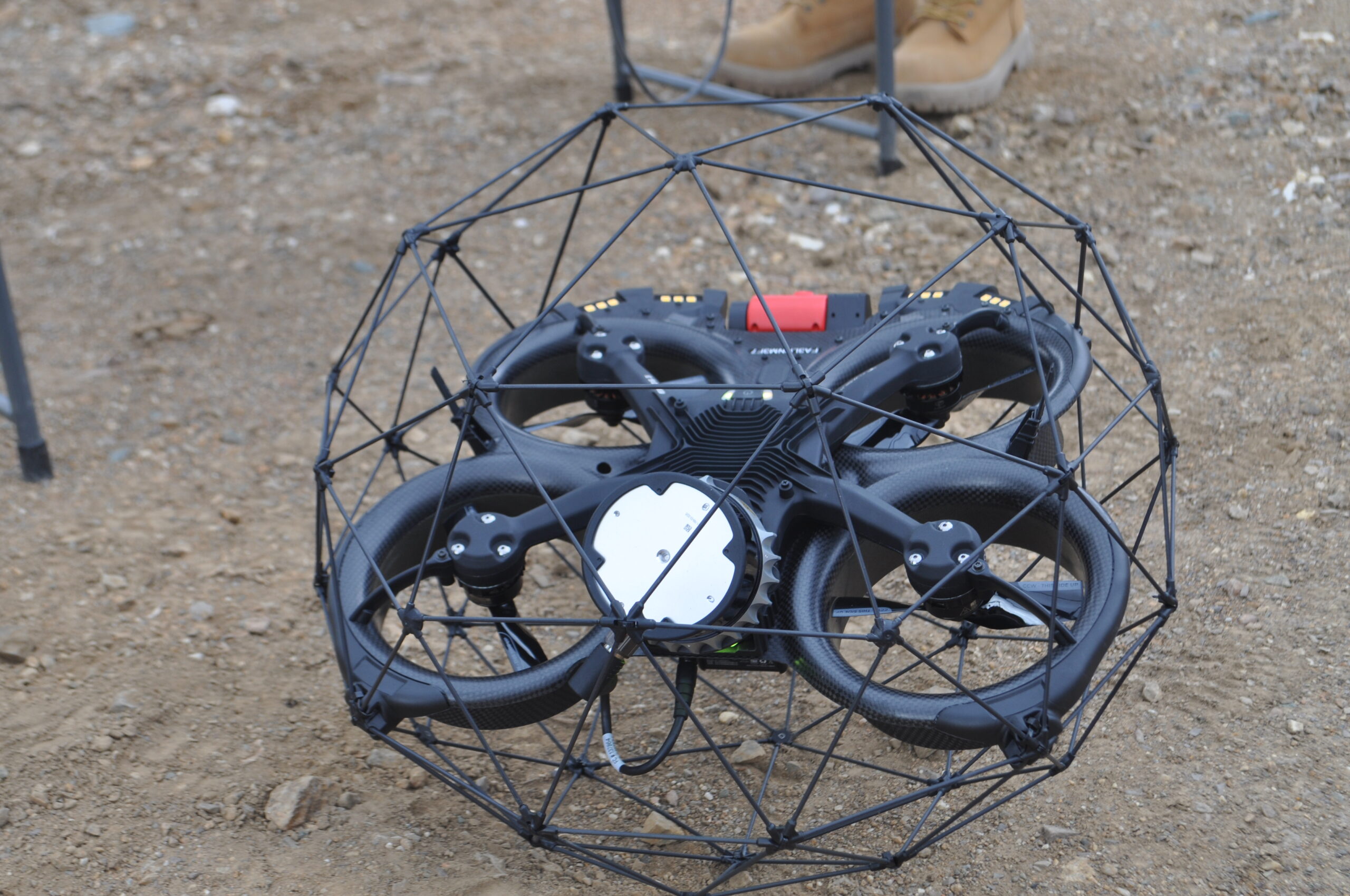
Technology Used: Drone LiDAR using ELIOS 2 & 3 caged drones, ground LiDAR using Leica and EXYN 3D scanners and numerous CAD modeling software packages (including Leica Cyclone and 3D Reshaper)
Deliverable: 3D as-built models
Accuracy: +/- 6mm
Key Challenges
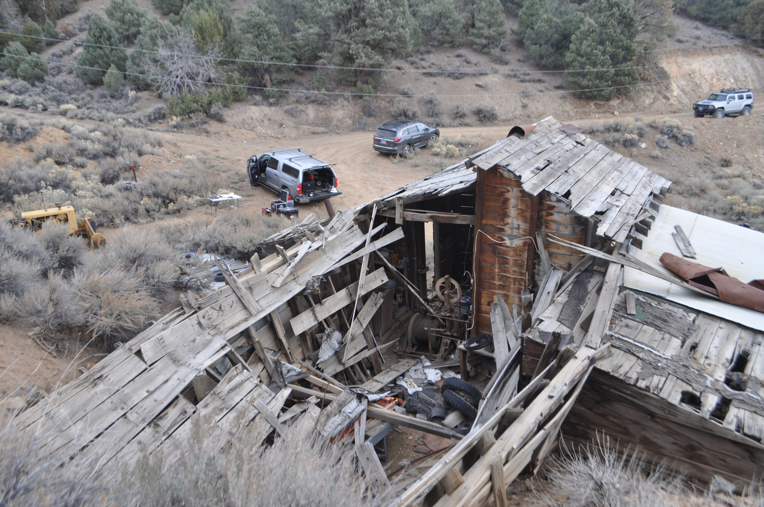
Old mine plans with hand drawn underground maps were just the beginning of the challenges the customer faced. Unable to descend into the main entrance shaft of the mine during preliminary inspections, the mine geologists immediately recognized the limitations of their assessment ability, due to unexpected shaft geometry and concerns for personnel safety. Upon tunnel entry by foot, odd shaft angles, partial tunnel collapse, and rock falls were observed — clear indicators of unsafe and hazardous conditions. Advanced technology would be needed to complete the safety and operational assessments to determine if this inactive mine could be returned to operations.
Based on these initial visual inspections, Darling Geomatics knew a comprehensive inspection plan was needed to accurately — and safely — map the underground workings. Darling needed to capture the greatest amount of accurate and repeatable data, with the least risk to personnel safety, in the quickest time possible.
Solution
With decades of mine surveying expertise, Darling Geomatics reviewed the geologists’ concerns, existing maps and assessed the overall risk to personnel safety to develop a detailed multi-crew inspection plan that would deliver on safety, precision and accuracy.
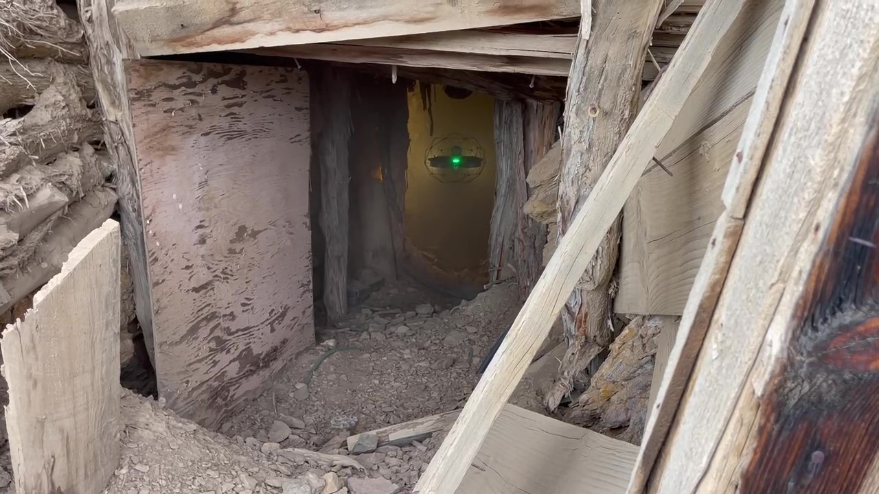
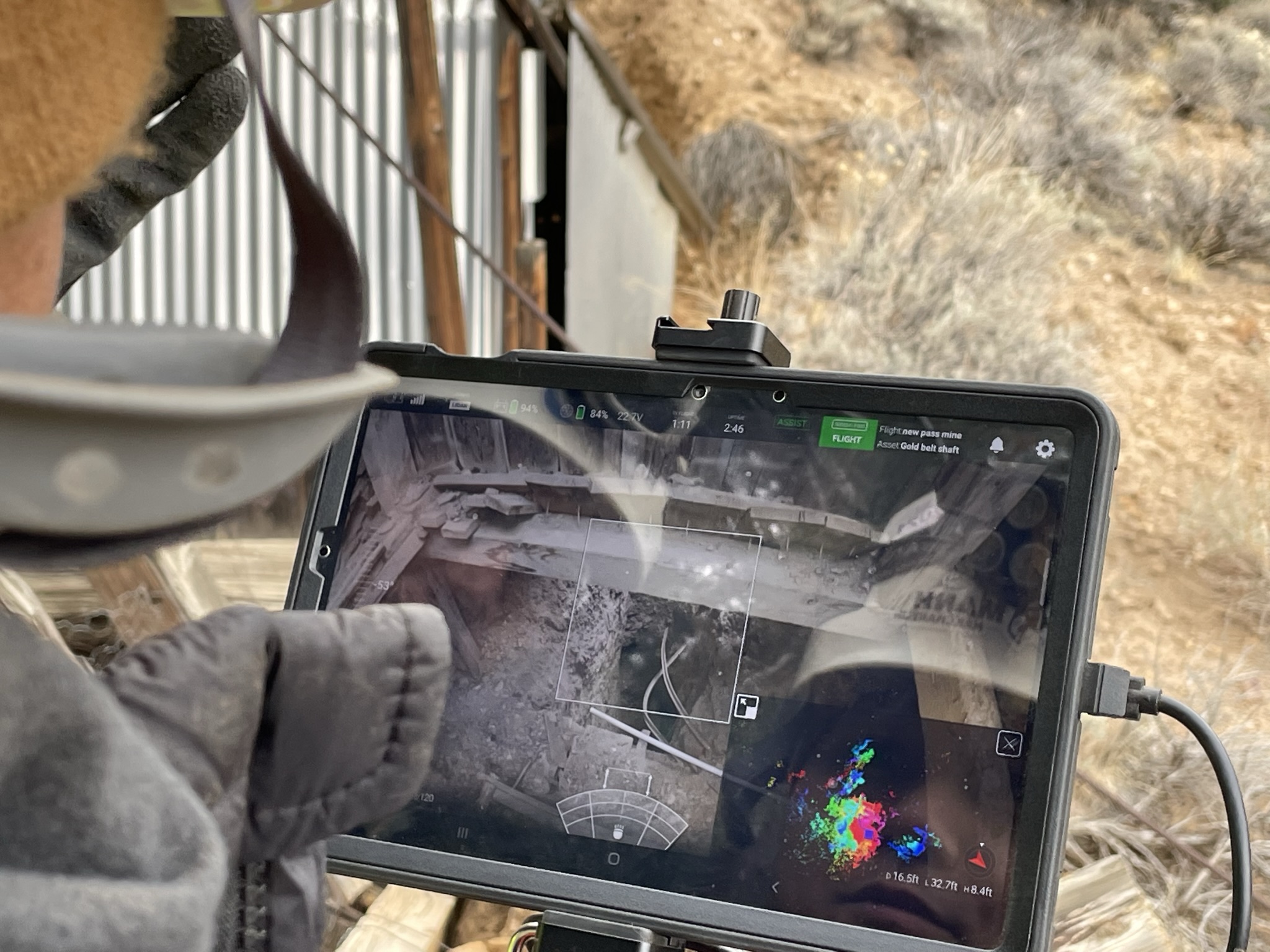
Over several surveys, the Darling crews deployed caged drones and ground-based LiDAR (3D laser scanning) to confirm shaft geometry, size, shape and locations of open stopes, adits and tunnels. When access or crew safety was uncertain, drones were safely flown through partially collapsed tunnels to complete their data-capturing missions. The resulting aerial and terrestrial surveys returned billions of points of data that the Darling crews used to create high-density point cloud maps.
Darling Geomatics completed the project in a matter of days and delivered highly detailed and georeferenced 3D as-built models to the customer. Meeting the client’s requirements, the final deliverable used the same mine coordinate system to facilitate design engineering of future upgrades.
"When safety is a concern — send the drone, not the person."
Outcome
After only a few days, the Darling team’s expertise in mine surveying coupled with 3D surveying advancements and state-of-the-art equipment, precise 3D as-built models were captured with the least possible risk to personnel. Upon delivery of the 3D as-built models, the mine had the data they needed to complete their safety and operational assessments. Extremely pleased with the results, the mine has already put plans in place for additional surveying and mapping in 2023.
With the rapid pace of innovations in underground mine mapping and inspecting, geospatial experts like Darling Geomatics expect AI to feature even more prominently in the future — delivering greater, more complete data, within reduced time frames — further minimizing risk to mining and inspection personnel. Autonomous drones and robotic systems are expected to extend even deeper for safe and reliable underground exploration in the future. This technology will continue to improve for mines, subways, railroad and passenger vehicles, as well as for environmental and archaeological studies of natural caves.
Additional Information