APPLICATIONS:
Mitigate Risk with 3D Clash Detection
Digital construction verification helps ensure that work progresses efficiently and as designed in a way that traditional spot checking can never accomplish. Using 3D scanning and advanced software, fast clash detection and construction verification allow you to save time and money by pinpointing problems early. Darling Geomatics’ state-of-the-art technology allows us to verify 100% of your construction in the time it takes you to check 5%. 3D verification streamlines workflow by enabling virtual collaboration between all of your team members. It allows you to accurately verify the work of subcontractors or to identify variances to the as-designed plan in near real-time so that you can react quickly to potential delays or reworks that can drive up costs. Partner with us to mitigate risk with our new 3D Construction Verification service.
Best Practices in Construction Verification
Let's talk about what makes construction verification work well in today's building industry. Having a solid verification process is absolutely essential to making sure your construction project hits all the right marks - from meeting building codes to following design specifications. The most successful approach combines regular on-site inspections with thorough documentation and testing throughout the build.
Think of it as having a skilled detective on your team who checks everything from structural elements to mechanical systems, using high-tech tools like thermal cameras and moisture meters to catch potential issues before they become real problems. The key is having your verification team maintain open lines of communication with everyone involved - your contractors, architects, engineers, and project managers all need to be on the same page.
When you follow these verification best practices consistently, you're much more likely to avoid expensive mistakes, keep your project running smoothly, and deliver exactly what your client expects - all while staying within code requirements and professional standards.
Advances in 3D scanning technologies and data analysis software have set a new standard in intelligence for facility owners, architects, engineers and contractors. We can now show you in 3D exactly where and how much your building varies from design.

See It for Yourself
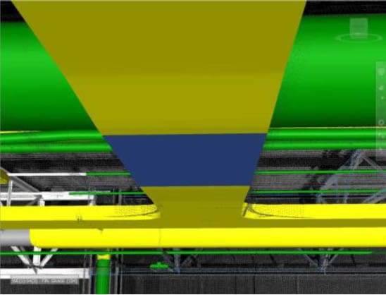
Above is an example of 3D construction verification inside a 1.25 million square foot manufacturing plant in the southeastern USA.
- Green objects are within tolerance.
- Yellow objects are out of tolerance.
- Blue objects are comparisons being processed at the moment this image was captured.
Schedule a Demo
Contact us to schedule a short demo of our 3D construction verification.
