INDUSTRIES:
The Future is Now
Darling Geomatics specializes in solar, wind and other renewable energy. Land status research, acquisition, topographic mapping (ground and aerial), construction layout, construction verification, monitoring and more. Darling Geomatics has the expertise to meet your needs.
Traditional methods of measuring oil and gas facilities, solar farms, power generation plants including nuclear plants, substations and distribution lines can take weeks with several crew members, several site visits, and substantial safety risks. Darling Geomatics integrates high tech tools including 3D scanning and UAV (drone) surveys to continually improve the way they survey for energy companies. The technology increases safety as well as reducing the time and cost of our services.
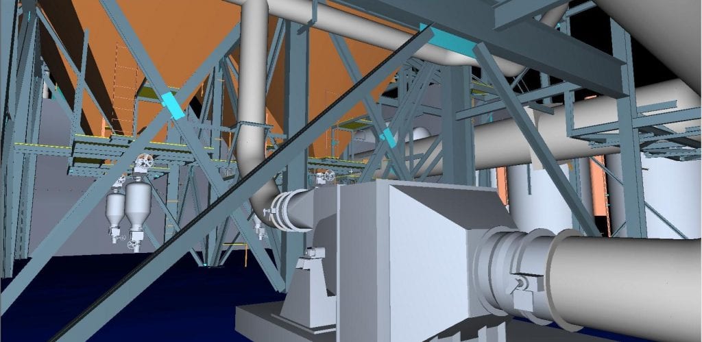
How would you accurately measure pulverized coal piping that weaves up through four floors to a burner? With our 3D scanning equipment, it's less difficult (and less expensive) than you think.
One local engineer was able to utilize our 3D models to reduce his substation expansion design time from 20 days to 1 day.
Darling measures a typical substation in less than five hours without touching anything. This avoids costly downtime and interrupted electrical service to customers. Our crew stays a safe distance from dangerous high voltage areas. We eliminate the need to revisit a site to collect more measurements. Our electrical utility clients are thrilled to receive a 3D solid model of the substation to incorporate into their 3D substation designing software.
Darling’s 3D scan and UAV (drone) data provides information that otherwise might be missed. Electrical, mechanical and plumbing engineers as well as civil and structural engineers use this data to avoid clashes when designing around pre-existing assets.
Darling scans new assets as well, to show accurate as-built conditions and compare those to the planned drawings; and red line the differences. Did the contractor place that footer in the right place? Are those bus components at the proper elevation? Our 3D scanning and UAV (drone) survey capabilities answer those questions.

Affiliations
Darling Geomatics is proud to be a member of the following:

