APPLICATIONS:
PV Solar Farm Inspections
Our solar power plant inspection services put the latest in UAV technology and aerial thermography software to work for you. Traditional PV solar farm inspections can take days to complete. However, we employ sophisticated precision equipment that reduces inspection time, producing reliable results that ultimately help maximize energy production and increase profitability.
Keep the Energy Flowing
Managing a huge solar power generation site presents unique challenges. We employ FLIR-equipped UAVs with Zenmuse XT 640×512 resolution radiometric infrared camera to:
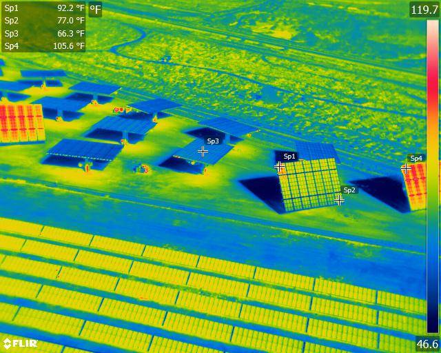
Aerial radiometric imagery provides georeferenced data on every pixel of the thermal image.
PV Solar Farm Inspections Deliver Pinpoint Accuracy
Every pixel contains x, y, z coordinates and temperature to produce an accurate energy efficiency audit. Such precise georeferenced data allows you to quickly pinpoint problems and identify areas needing improved efficiency.
Our Drone Surveying Company has Decades of Experience
Darling Geomatics brings decades of precision surveying experience to your site. We employ only FAA-licensed pilots who fly our FAA-registered aircraft, and we deliver data in any format required. When you have to have reliable results, we deliver.