SERVICES:
What Is 3D Scanning? Understanding the Technology and Benefits
3D scanning is the process of capturing the exact size, shape, and surface details of physical objects or environments using high-precision laser technology. At Darling Geomatics, we use advanced terrestrial LiDAR (Light Detection and Ranging) scanners to collect millions of data points with millimeter-level accuracy. The result is a detailed 3D point cloud that can be transformed into models, drawings, or digital twins.
This technology allows us to document existing conditions with unmatched precision—ideal for engineering, construction, historic preservation, and facility management.
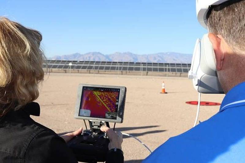
Fast, Cost-Effective 3D Drone Scanning Outperforms Traditional Methods

Key Differences Between 3D Scanning and Drone Surveying
While both drone surveying and 3D scanning create accurate digital representations, they serve different purposes:
- 3D Scanning – Ground-based, ultra-detailed measurements. Perfect for buildings, interiors, industrial plants, bridges, tunnels, and other structures requiring fine detail.
- Drone Surveying – Aerial data collection. Best for large sites, open terrain, floodplains, stockpiles, or inaccessible areas where speed and coverage are critical.
At Darling Geomatics, we don’t view these as competing technologies but as complementary tools. Drone surveying gives a broad, accurate overview of the landscape, while 3D scanning fills in the fine details of the built environment. Together, they deliver a complete and reliable dataset.
What Is a Point Cloud Survey?
A point cloud is a three-dimensional dataset composed of millions — sometimes billions — of individual georeferenced measurement points, each capturing an exact X, Y, and Z coordinate in space. When our LiDAR scanning equipment sweeps a structure, terrain, or industrial asset, it emits rapid pulses of laser light and precisely measures the time each pulse takes to return. The result is an extraordinarily dense, spatially accurate digital representation of the real world — every surface, edge, elevation change, and structural detail captured as a measurable data point.
Unlike traditional survey methods that produce abstract lines and annotations, a point cloud preserves the full physical reality of what was scanned. You can navigate through it, measure any distance within it, extract cross-sections and profiles at any angle, and use it as the foundational dataset for nearly any downstream deliverable — floor plans, as-built drawings, BIM models, topographic maps, or structural assessments.
How Point Cloud Data Is Used
Point cloud surveys serve a wide range of industries and project types, typically wherever precision spatial data drives design, construction, or inspection decisions:
- As-built documentation — capturing existing conditions of structures, facilities, or infrastructure exactly as they are, not as they were designed
- Building Information Modeling (BIM) — serving as the georeferenced base from which accurate Revit, AutoCAD, or Civil 3D models are built
- Structural and heritage recording — preserving dimensional records of bridges, historic buildings, and industrial assets for restoration, compliance, or archival purposes
- Construction verification — comparing scan data against design drawings to identify deviations before they become costly field problems
- Topographic and site surveys — capturing terrain, cut-and-fill volumes, drainage patterns, and surface conditions for civil and land development projects
- Industrial plant and pipeline surveys — mapping complex mechanical systems, piping, and equipment layouts for retrofit, maintenance, or decommissioning planning
- Clash detection — identifying spatial conflicts between new and existing systems before work begins
The power of a point cloud is its permanence and completeness. Once scanned, the data can be revisited indefinitely — measurements taken, details extracted, and new deliverables generated — without returning to the field.
Darling Ltd's LiDAR Scanning: Top-Line Point Cloud Deliverables
At Darling Ltd, our 3D scanning services are built around professional-grade terrestrial and mobile LiDAR systems that produce survey-accurate point clouds registered to your project's coordinate system and datum. We don't simply collect raw data — we deliver fully processed, georeferenced, and quality-controlled point cloud datasets ready for immediate use by your project team, engineers, or modeling contractors.
Our deliverables meet the density, accuracy, and registration standards required by engineering, architectural, and survey-grade workflows. Whether your team works in Autodesk ReCap, Leica Cyclone, Trimble RealWorks, or a downstream BIM or CAD environment, our deliverables arrive in the format your workflow demands — LAS, LAZ, RCP, E57, or project-specific formats — with full metadata, scan registration reports, and accuracy statements.
Every Darling point cloud survey is carried out by licensed survey professionals, ensuring that the spatial accuracy of your data isn't just technically capable — it's legally defensible and meets the standards required for engineering design, construction documentation, and regulatory submission.
How Darling Clients use 3D Scanning (In the Real World)
Darling Geomatics’ clients use 3D scanning as construction reality capture—a fast, accurate way to measure existing conditions and compare what’s in the field to what was designed. Instead of spot-checking a handful of points, your team gets a dense 3D point cloud (and often a 3D model) that can be reviewed, shared, and measured from the office. That supports better decisions earlier, fewer surprises during construction, and clearer documentation at closeout.
Types of 3D Scanning Technologies (and How Clients Apply Them)
LiDAR (laser-based point clouds)
Clients use LiDAR when they need dependable, geometry-first capture for terrain, structures, and complex surfaces—especially where accuracy matters more than “pretty visuals.” Typical construction and land development uses include topographic surfaces for planning and grading, quantity support for earthwork, roadway/site context, and capturing existing structures for design coordination. LiDAR reality capture is also ideal when you need repeatable datasets for progress comparisons over time.
Terrestrial laser scanning (high-accuracy site and structure capture)
Laser scanning is often the go-to when clients need sub-centimeter detail for buildings, MEP spaces, industrial facilities, or tight tolerances. Common workflows include scan-to-BIM, retrofit planning, renovation documentation, structural measurements, and construction verification where teams want to confirm layout, penetrations, embeds, slab edges, steel alignment, or installed equipment against plans. This is also where teams get huge value from remote measurement—answering questions without sending someone back into the field.
Photogrammetry (drone/camera-based 3D models)
Clients use photogrammetry to cover larger areas quickly—site-wide mapping, stockpile volumes, cut/fill context, corridor progress, and general conditions documentation. It’s especially useful for early planning, ongoing progress visuals, stakeholder communication, and frequent updates across expansive sites. When paired with control and the right workflow, photogrammetry becomes a powerful reality capture layer for schedule tracking and earthwork reporting.
What Clients Actually Do With the Data
Darling’s scanning deliverables are typically used in four repeatable ways:
- Design and preconstruction: Capture existing conditions to reduce RFIs, validate assumptions, and align teams before mobilization.
- Construction verification and QA/QC: Compare the as-built point cloud to CAD/BIM to identify variances early (before they become rework).
- Progress tracking and reporting: Create time-stamped reality capture checkpoints to verify work completed, support pay apps, and document disputes.
- As-builts and closeout: Provide accurate as-is documentation for turnover, facility management, renovations, and future expansions.
Benefits of 3D Scanning
3D scanning delivers unmatched accuracy with sub-centimeter precision to improve project outcomes. It speeds up data collection, reducing field time and cutting costs. Safety improves as scanning minimizes the need for personnel in hazardous environments. High-resolution 3D models enhance visualization, planning, and communication with stakeholders. Overall, 3D scanning streamlines workflows, boosts productivity, and lowers risk on every project.
Our Expertise and Experience in 3D Scanning and Surveying
Darling Geomatics has more than two decades of experience providing cutting-edge surveying solutions. Our team of licensed surveyors and geospatial professionals were early adopters of 3D scanning technology, applying it to projects in:
- Construction – Capturing as-built conditions for clash detection, quality assurance, and design verification.
- Industrial Facilities – Creating 3D models of plants, refineries, and manufacturing sites for maintenance planning and upgrades.
- Historic Preservation – Digitally documenting historic structures to preserve them for restoration and research.
- Healthcare & Sports Facilities – Delivering precise interior scans for renovations, expansions, and safety planning.
Our proven process ensures fast, accurate, and cost-effective deliverables for clients across industries.
How Our 3D Scanning Process Works
Step 1 — Site Capture
Our field team deploys the appropriate scanning technology for your project — drone LiDAR for large sites and earthworks, mobile LiDAR for corridors and facilities, or terrestrial laser scanning for buildings and structures requiring the highest geometric accuracy. A typical commercial building capture takes 1–2 days on site.
Step 2 — Point Cloud Processing
Raw scan data is registered, georeferenced, and cleaned in our office using industry-standard processing software. The result is a dense, calibrated 3D point cloud that accurately represents every surface captured in the field — ready for your team to work with or for us to process further.
Step 3 — Deliverable Production
Depending on your project requirements, we convert the point cloud into your requested deliverable: a BIM model (Revit, AutoCAD), 2D as-built drawings, a topographic survey, a volume report, or a raw point cloud in LAS/RCP format for your own team to work from.
Step 4 — QA & Handoff
Every deliverable goes through internal QA review for accuracy and completeness before delivery. We include a project summary report noting scan coverage, accuracy specifications, coordinate system, and software compatibility — so your team knows exactly what they're working with.
3D Scanning & Reality Capture for Construction Projects
Darling Geomatics provides professional 3D scanning and reality capture services for construction projects of every scale. Using drone LiDAR, mobile LiDAR, and terrestrial laser scanning, we capture precise, millimeter-accurate spatial data of existing conditions, active construction sites, and completed structures — then deliver it in the format your team needs to move forward.
Our clients include general contractors, structural engineers, BIM coordinators, civil project managers, and facility owners who need reliable field data without the cost and delay of traditional survey methods. Whether you're documenting conditions before a renovation, verifying earthwork volumes, or building a BIM model from a scanned structure, Darling has the equipment, expertise, and turnaround speed to keep your project on schedule.
What is Reality Capture?
Reality capture is the process of digitally documenting the physical world using scanning and imaging technologies — creating an accurate, data-rich 3D representation of a space, structure, or site that can be used throughout a project's lifecycle.
In construction, reality capture typically involves laser scanning or LiDAR technology that emits millions of light pulses per second and measures how they reflect back off surfaces. The result is a point cloud — a dense, georeferenced 3D dataset that captures every dimension of what the scanner sees with sub-centimeter accuracy.
That point cloud becomes the foundation for a wide range of deliverables: as-built drawings, BIM models, topographic surveys, volume calculations, and inspection reports. Unlike manual measurement or photography, reality capture is non-destructive, comprehensive, and far less prone to human error.
For construction teams, this means fewer RFIs, fewer change orders, and fewer surprises in the field. When design models are built on accurate scanned data rather than outdated drawings or assumptions, clashes get caught in the office — not on the job site. Reality capture is no longer a specialty service reserved for large infrastructure projects; it's become a standard risk management tool for contractors and engineers who can't afford to be wrong.
3D Scanning Services for Every Stage of Construction

Pre-Construction Site Survey
Capture existing site conditions with LiDAR before design begins — eliminating surprises and giving your engineers accurate ground truth data from day one.

Renovation & As-Built Scanning
When legacy drawings are missing or inaccurate, a single scan of your existing building replaces weeks of manual measurement and gives architects and GCs reliable as-built documentation to design from.
→ Learn more about renovation scanning

Clash Detection
Feed scanned as-built data into your BIM model to identify real-world MEP and structural conflicts before construction begins — reducing costly rework and schedule delays.
→ Learn more about clash detection scanning

Earthwork Volume Calculation
Accurate cut/fill volumes, stockpile measurements, and grading verification using drone LiDAR — faster and more defensible than traditional survey methods for civil and heavy construction projects.
→ Learn more about earthwork volume LiDAR

Scan to BIM
We convert scanned point cloud data into fully coordinated BIM models in Revit, AutoCAD, or Civil 3D — delivered at your specified Level of Development (LOD) for design, coordination, or facilities management.
→ Learn more about Scan to BIM services

Structural Inspection & Documentation
Non-destructive 3D documentation of existing structures to assess deformation, settlement, and deterioration — giving structural engineers and facility owners the data they need to make confident repair and maintenance decisions.
→ Learn more about structural inspection scanning
Maximizing Results: Combining 3D Scanning with Drone Surveying
The real advantage comes when these two technologies are used together. Drone aerial surveying provides a rapid, wide-area view of terrain and site conditions. 3D scanning then adds fine-grained measurements of structures within that site.
By combining both, we can deliver a complete dataset that supports:
- Full digital twins of facilities and properties
- Seamless integration with BIM and GIS systems
- Accurate planning for infrastructure and utility projects
- Reduced rework, risk, and costly site revisits
Clients gain the confidence that every angle, elevation, and detail has been captured.
Safety and Environmental Compliance
Our 3D scanning solutions support stringent safety and environmental standards. By capturing data remotely, we reduce onsite exposures and safeguard workers. Accurate models help ensure compliance with regulatory requirements and environmental protection plans. Regular scans monitor site conditions for deformation or hazards. We follow industry best practices and local regulations to deliver data that supports safer, greener mining and construction operations.
What You Get from a 3D Survey
Every 3D survey project delivers data in formats that fit your workflow:
- Point clouds - Raw 3D survey data (E57, RCP, LAS) for design software and analysis tools
- CAD drawings - 2D plans, sections, and elevations extracted from 3D survey point clouds
- BIM models - Intelligent 3D models (Revit) for construction coordination and facility management
- Orthomosaic maps - High-resolution aerial imagery georeferenced for GIS and site planning
- Digital twins - Interactive 3D environments for visualization, training, and operations planning
- Mesh models - Textured 3D surfaces for visualization and gaming engine integration
We work with your team to determine which deliverables best support your project goals.
Partner with Darling Geomatics
Whether your project requires ultra-detailed 3D scanning, broad drone-based aerial mapping, or both, Darling Geomatics has the expertise to deliver accurate, actionable results. Our FAA-certified pilots, licensed surveyors, and scanning specialists bring decades of experience to every project.
- Survey-grade accuracy — Our scanning workflows achieve positional accuracies of 2–6mm depending on project type and methodology, verified against ground control points
- Full-stack delivery — We don't just hand over a point cloud; we produce construction-ready BIM models, drawings, and reports your team can act on immediately
- Multi-technology capability — Drone LiDAR, mobile LiDAR, and terrestrial laser scanning under one roof — we select the right tool for your site, not the one tool we own
- Fast turnaround — Standard deliverables within 5–10 business days of site capture; expedited options available for time-sensitive projects
- BIM-compatible outputs — All deliverables are formatted for direct use in Autodesk Revit, AutoCAD, Civil 3D, Navisworks, and Bentley MicroStation
- Licensed geomatics professionals — Our team holds professional certifications in geomatics and surveying, giving your deliverables the technical credibility required for engineering and permitting use
Work with a partner that understands the technology—and how to combine it for the greatest impact.
Contact Us Today to learn how our 3D scanning services can elevate your project.
3D Survey Frequently Asked Questions
Our Certifications, Licenses & Affiliations
Darling Geomatics is proud to be a member of the following:

