APPLICATIONS:
How Drones Revolutionize 3D Topographic Mapping
Drone topography allows you to collect data on large swaths of ground quickly and safely. The resulting 3D topographic maps and models provide solutions for engineering, architectural design, infrastructure, urban planning, and more.
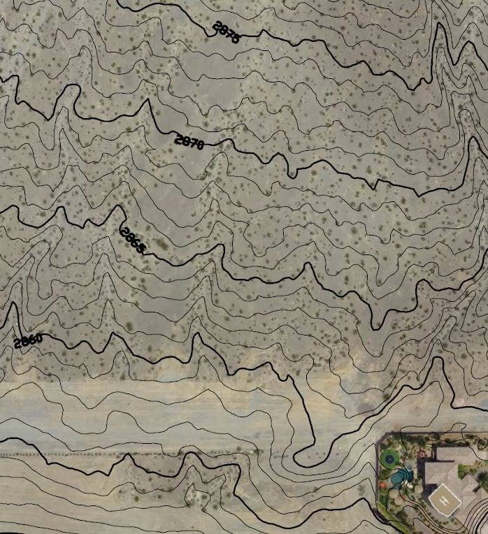
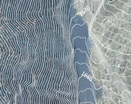
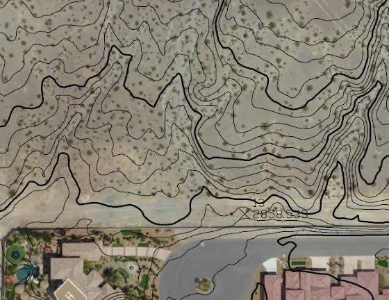
Drones equipped with LiDAR scanners produce massive 3D point clouds that can be used to create AutoCAD contours or contour maps. These highly accurate pictures of ground characteristics can be used to predict water flow, identify populated or forested areas, see existing transportation infrastructure, measure slopes, or pinpoint peaks and valleys. Topographic maps have applications across an array of professions and integrate seamlessly with our LiDAR scanning services.
Proven Process for Accurate 3D Topographic Mapping
Darling Geomatics delivers centimeter-level precision that meets professional surveying standards. Our drone topographic surveys achieve +/-2.5 inch accuracy using RTK positioning systems and strategically placed ground control points. Modern UAV technology captures data accurate to within 1-3 times the ground sampling distance. With 2 cm ground resolution, you get 2-6 cm precision both horizontally and vertically. This exceeds ASPRS Class I mapping requirements for engineering and construction applications. Ground control points ensure absolute accuracy throughout your project area. Our RTK-equipped drones maintain centimeter precision across hundreds of acres, delivering the reliable data you need for critical decision making. Every survey includes checkpoint validation to verify final accuracy against known coordinates. You receive detailed accuracy reports with your deliverables, providing confidence in your project data.
High Quality Topographic Mapping Enables Precise Project Planning
Tools such as high-resolution aerial maps and bare earth models can be easily accessed by everyone associated with a project, making resource and logistical planning faster and more accurate. Darling Geomatics provides 3D topography services for:
Drones Changed 3D Topography
The adoption of drones, or UAVs, in 3D topography enabled the collection of massive amounts of data in a short amount of time. 3D topography allows us to obtain high resolution true color aerial photographs of an entire project area during a single flight.
With the introduction of drones, the time necessary for collecting data was reduced from weeks to days. In addition to being faster, drone surveying costs a fraction of manned aircraft surveys.
Our ground crews consist of FAA licensed UAV pilots who are registered surveyors with decades of experience. They complete surveys efficiently and quickly, staying safely earthbound and far from any hazards.
The data can be input and delivered in any CAD, non-CAD, 2D and/or 3D format your project requires. We are able to acquire latitude, longitude and elevation (x, y and z) data accurate to within +/- 6-7 cm (+/-2.5 in).
Proven Process, Reliable Results
Our systematic approach ensures accurate, comprehensive topographic data for every project. Decades of surveying experience guide our drone operations from initial planning through final delivery. Pre-flight planning establishes optimal flight paths and identifies potential obstacles. Ground control points are positioned strategically across your site to maximize geometric accuracy and coverage efficiency.
Data collection uses overlapping flight patterns with 80% forward and 60% side overlap for complete terrain capture. FAA-licensed pilots operate RTK-equipped drones to maintain positioning accuracy throughout the survey. Processing transforms raw imagery into precise 3D models, contour maps, and CAD-ready deliverables. Quality control includes independent checkpoint verification to validate accuracy specifications before delivery.
Final deliverables arrive in your preferred format - AutoCAD contours, GIS-compatible files, or 3D point clouds. All data includes coordinate system documentation for seamless integration with existing project files.
Why Drones Changed Everything
Drone topography delivers the same accuracy as traditional methods in a fraction of the time. What once took weeks is now completed in days, with comprehensive coverage traditional surveys cannot match. Traditional ground surveys require physical access to every measurement point. Our drones capture millions of elevation points safely from above, including hazardous or inaccessible terrain areas.
Speed advantages translate directly to cost savings. Drone surveys typically cost 50-70% less than traditional methods while providing exponentially more data points for better terrain modeling. Safety benefits eliminate crew exposure to traffic, unstable ground, and hazardous conditions. Surveyors operate from secure locations while capturing complete site documentation remotely.
Data density exceeds traditional capabilities by orders of magnitude. Where traditional surveys capture hundreds of points, drones collect millions - providing detailed terrain models impossible with ground-based methods.
Traditional surveying remains essential for property boundaries and control networks requiring sub-centimeter precision. For topographic mapping, drone technology now matches traditional accuracy while offering substantial time and cost advantages.
High Quality Maps Enable Accurate Project Planning
Tools such as high-resolution aerial maps and bare earth models can be easily accessed by everyone associated with a project, making resource and logistical planning faster and more accurate.
Frequently Asked Questions About 3D Topography and Topographic Mapping


