
The landscape of land surveying has undergone a dramatic transformation, moving far beyond the limitations of ground-based methodologies. Today, aerial platforms equipped with advanced sensors are not just supplementary tools but are increasingly becoming the primary means of data acquisition. This shift is driven by a demand for faster, more comprehensive, and more accurate information for a wide array of projects.
For professionals in engineering, construction, and development, embracing these aerial technologies offers a significant competitive advantage. Understanding the capabilities and strategic application of these drones is paramount to unlocking their full potential and ensuring project success. This exploration delves into how these modern marvels are redefining site assessment and providing unprecedented insights.
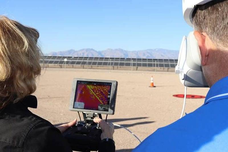
Featured image for Aerial Land Survey Drone: Beyond Traditional Methods
Revolutionizing Site Assessment: The Ascent of Aerial Drone Surveys
The integration of aerial drone surveys marks a pivotal evolution in how we understand and interact with the physical environment. Traditional methods, while foundational, often involved laborious processes with inherent limitations in speed and scope. Drones, equipped with sophisticated sensor payloads, have overcome many of these hurdles, offering a more dynamic and data-rich approach to site assessment. This technology allows for rapid deployment and coverage of vast areas, providing a comprehensive overview that was previously difficult or impossible to achieve efficiently. The ability to capture detailed imagery, topographic data, and volumetric calculations from an aerial perspective significantly enhances the initial stages of any project, from initial planning to ongoing monitoring.
This technological leap is particularly crucial in sectors like infrastructure development, real estate, and environmental management, where an accurate and up-to-date understanding of the terrain is critical. The insights gained from drone surveys enable more informed decision-making, leading to optimized designs, reduced risks, and improved project outcomes. The sheer volume and detail of data collected enable a deeper understanding of site conditions, contributing to more robust planning and execution phases.
Bridging the Gap: From Traditional Topography to High-Density Point Clouds
The transition from traditional topographic surveys to modern aerial drone methodologies represents a significant leap in data fidelity. Where traditional methods might yield sparse contour lines, drone surveys, especially those employing photogrammetry or LiDAR, generate high-density point clouds. These point clouds are dense collections of millions or even billions of individual 3D coordinate points, meticulously mapping every visible surface. This granular data allows for the creation of incredibly detailed and accurate 3D models of the terrain, existing structures, and vegetation. The difference is akin to viewing a detailed architectural blueprint versus a simple sketch; the point cloud provides a level of geometric precision essential for advanced engineering applications and digital twin creation. This enhanced data resolution is crucial for identifying subtle topographical features, managing complex earthworks, and ensuring precise placement of new infrastructure.
Furthermore, the integration of these point clouds into Geographic Information Systems (GIS) and CAD software enables advanced analysis and visualization. Professionals can now perform detailed volumetric calculations for stockpiles, conduct precise cut-and-fill analyses, and even simulate drainage patterns with unprecedented accuracy. This capability fundamentally changes the way site development is planned, moving from generalized estimations to highly precise, data-driven decisions. The ability to integrate this data seamlessly with other project information streamlines workflows and reduces the potential for costly errors that could arise from less detailed surveys. For instance, in Arizona, understanding subtle elevation changes is critical for water management and construction in diverse terrains, making these detailed point clouds invaluable.
The Evolving Landscape of Geospatial Data Acquisition in 2026
The field of geospatial data acquisition continues its rapid evolution, with drone technology at its forefront. By 2026, the capabilities and accessibility of aerial surveying tools have expanded significantly. We are seeing a maturation of drone platforms that incorporate multi-spectral, thermal, and even hyperspectral sensors alongside high-resolution RGB cameras and LiDAR scanners. This multi-sensor approach allows for the capture of a much broader spectrum of information about a site, moving beyond mere physical dimensions to include thermal characteristics, vegetation health, and material composition. Such comprehensive data is invaluable for environmental impact assessments, utility inspections, and precision agriculture, demonstrating the expanding utility of these aerial assets. The trend is towards integrated data solutions that provide holistic insights rather than isolated measurements.
Moreover, advancements in artificial intelligence and machine learning are increasingly being applied to drone-captured data. Automated feature extraction, object recognition, and change detection algorithms are becoming more sophisticated, reducing manual processing time and enhancing the speed at which actionable intelligence can be derived. This synergy between advanced hardware and intelligent software is democratizing access to high-level geospatial analytics. Companies are now able to leverage services that provide not just raw data, but processed insights, significantly accelerating decision-making cycles and reducing the need for specialized in-house expertise in data processing. This makes cutting-edge geospatial analysis more attainable for a wider range of industries.
Unpacking the Capabilities of a Modern Aerial Land Survey Drone
A modern aerial land survey drone is far more than just a flying camera; it's a sophisticated data acquisition platform designed for precision and efficiency. At its core lies a robust airframe, engineered for stability and endurance, capable of carrying a variety of advanced sensors. These payloads are the true differentiators, including high-resolution cameras for photogrammetry, LiDAR scanners for 3D point cloud generation, thermal sensors for heat signature analysis, and even multispectral sensors for vegetation and material assessment. The onboard navigation systems are typically augmented with high-precision GPS and inertial measurement units (IMUs), allowing for accurate flight path control and georeferencing of captured data. Many professional-grade drones also feature sophisticated obstacle avoidance systems, ensuring safe operation even in complex environments.
The software ecosystem surrounding these drones is equally critical. Flight planning applications allow users to define precise survey routes, altitudes, and overlap parameters, ensuring consistent data capture. Post-processing software then takes the raw sensor data and transforms it into usable outputs such as orthomosaic maps, 3D models, and detailed topographic reports. For industries requiring extreme accuracy, such as precise engineering or construction layout, drones equipped with Real-Time Kinematic (RTK) or Post-Processed Kinematic (PPK) capabilities are essential. These technologies correct for GPS signal drift, achieving survey-grade accuracy down to the centimeter level, a significant improvement over standard GPS. The integration of these technologies ensures that the data collected is not only comprehensive but also highly reliable for critical applications.
Precision Mapping & Data Capture: How Drones Elevate Accuracy
The ability of aerial drones to achieve remarkable precision in mapping and data capture is a primary driver of their widespread adoption. Traditional surveying methods can be time-consuming and may struggle to capture the intricate details of complex terrain or infrastructure. Drones, however, can systematically fly over a site, capturing overlapping imagery or laser pulses at programmed intervals and altitudes. This systematic approach ensures that every part of the surveyed area is covered thoroughly, minimizing gaps and inconsistencies. The accuracy of the final output is intrinsically linked to the quality of the onboard sensors, the precision of the drone's navigation system, and the rigor of the ground control points (GCPs) used for georeferencing. When these elements are meticulously managed, the resulting maps and models provide a level of detail and positional accuracy that is transformative for project planning and execution.
The advent of advanced drone technology has made it feasible to create highly detailed and accurate representations of any given area. This is crucial for a multitude of applications, from monitoring the progress of large-scale construction projects to performing detailed site analysis for environmental studies. The ability to generate deliverables with sub-centimeter accuracy allows engineers to design with greater confidence and construction managers to implement plans with fewer errors. This precision is not just about measurement; it’s about providing a reliable digital foundation upon which complex projects can be built, ensuring that physical reality aligns perfectly with digital models. The reliability of this data is paramount for sectors where even minor inaccuracies can lead to significant cost overruns or safety concerns.
Achieving Sub-Centimeter Accuracy with RTK/PPK Drones
For applications demanding the highest levels of geospatial accuracy, drones equipped with Real-Time Kinematic (RTK) or Post-Processed Kinematic (PPK) technology represent the pinnacle of precision mapping. Standard GPS receivers on drones can experience errors of several meters due to atmospheric disturbances and signal reflections. RTK and PPK systems, however, utilize a base station positioned at a known location to transmit correction data to the drone in real-time (RTK) or for post-flight processing (PPK). This differential correction method effectively eliminates most sources of GPS error, allowing for the precise georeferencing of every captured image or LiDAR point to within sub-centimeter accuracy. This level of precision is critical for tasks such as establishing precise control points, laying out complex building foundations, monitoring structural integrity, or conducting detailed volumetric analysis where minute variations matter.
The choice between RTK and PPK often depends on workflow preferences and operational constraints. RTK offers immediate accuracy in the field, allowing for real-time data validation and immediate use of georeferenced data. PPK, on the other hand, offers robust accuracy by allowing for more comprehensive data processing after the flight, often correcting for subtle errors that might persist even with RTK. For many professional land surveyors in Arizona, leveraging these technologies means delivering survey-grade data that seamlessly integrates with existing GIS and CAD workflows, such as those used by the Arizona land survey excellence initiatives. The investment in RTK/PPK capabilities directly translates into reduced rework, enhanced project reliability, and greater confidence in the spatial data used for critical decision-making.
Generating High-Resolution Orthomosaics and Digital Surface Models (DSMs)
Beyond simply capturing raw data, aerial drone surveys excel at transforming this information into actionable products like high-resolution orthomosaics and Digital Surface Models (DSMs). An orthomosaic is essentially a geometrically corrected aerial photograph that has been stitched together from multiple images. Unlike a standard photograph, an orthomosaic has a uniform scale and is free from perspective distortion, making it a highly accurate map that can be used for precise measurements and analysis. A DSM, derived from photogrammetry or LiDAR data, represents the elevations of all surfaces, including buildings, trees, and terrain, providing a detailed three-dimensional representation of the landscape. These outputs are invaluable for planning, design, and monitoring applications.
The creation of these detailed products requires meticulous flight planning to ensure sufficient image overlap and appropriate ground sampling distance (GSD), which determines the level of detail captured. Sophisticated photogrammetry software then processes these overlapping images, using algorithms to identify common points and reconstruct the 3D geometry of the scene. For professionals, the outputs of these processes, such as those discussed in 3D scanning and aerial surveys, offer a comprehensive and accurate view of the project site. This facilitates everything from accurate inventory management of construction materials to detailed environmental impact studies, providing a foundational dataset for a wide range of engineering and development projects.
Accelerating Project Timelines: Efficiency Gains with Aerial Drone Surveys
One of the most compelling advantages of incorporating aerial drone surveys into project workflows is the significant acceleration of timelines. Traditional methods of land surveying, which often involve manual measurement and data collection on foot or from manned aircraft, can be slow, labor-intensive, and weather-dependent. Drones, on the other hand, can cover vast areas much more quickly and efficiently. A single drone flight can capture data that might take ground crews days or even weeks to collect, especially in challenging or inaccessible terrains. This rapid data acquisition means that project planning, design, and execution phases can commence much sooner, directly impacting project delivery schedules and reducing associated costs. The ability to quickly obtain up-to-date site information is critical for keeping projects on track.
The efficiency gains extend beyond mere data collection speed. The processing of drone-captured data, while requiring specialized software, is also becoming increasingly automated and streamlined. This means that actionable insights, such as detailed topographic maps, volumetric calculations, and 3D models, can be generated in a fraction of the time compared to older methods. For construction managers, this rapid turnaround allows for quicker identification of potential issues, more agile responses to site changes, and more accurate progress monitoring. Furthermore, the reduced need for extensive fieldwork by personnel minimizes safety risks and frees up valuable human resources for other critical tasks. Ultimately, the integration of drones contributes to a more agile, responsive, and cost-effective project management strategy, a key differentiator in today's competitive market.
Enhancing Site Safety and Accessibility for Complex Terrain
Traditional land surveying methods in challenging environments, such as mountainous regions, dense forests, or active construction sites, often pose significant safety risks. Personnel may need to navigate treacherous slopes, unstable ground, or areas with limited visibility, increasing the potential for accidents. Aerial drone surveys dramatically mitigate these dangers by allowing data acquisition from a safe altitude. Drones can access areas that are physically inaccessible or prohibitively dangerous for ground crews, providing comprehensive coverage without exposing personnel to undue risk. This is particularly crucial for projects in areas like Northern Arizona, where rugged terrain is common. For instance, a drone can survey a steep canyon rim for preliminary design purposes, gathering detailed topographical data that would otherwise require complex and risky rope access or extensive hiking. This capability ensures that even the most remote or hazardous sections of a site are accurately mapped, contributing to better planning and reduced liability for all parties involved. Improved safety is a paramount benefit, directly translating to fewer incidents and a more secure working environment.
Beyond safety, drones significantly enhance site accessibility for comprehensive data collection. Reaching every corner of a large or irregularly shaped property on foot can be time-consuming and incomplete. Drones, equipped with high-resolution cameras and advanced sensors like LiDAR, can systematically cover vast areas with unparalleled detail. They can fly beneath bridges, over water bodies, or around obstacles that would impede ground-based efforts. This allows for a more thorough understanding of the site's conditions, including vegetation density, existing infrastructure, and potential environmental hazards. For development projects, this detailed access ensures that all site features are accounted for in the initial design phase, preventing costly omissions or changes later. The ability to perform frequent site visits via drone also allows for precise tracking of progress and immediate identification of any deviations from the plan, further solidifying control over complex projects. This comprehensive approach to accessibility ultimately leads to more informed decision-making and efficient project execution.
The Power of 3D: Creating Detailed Digital Twins from Drone Data
The data captured by aerial drones extends far beyond two-dimensional maps. Modern drone surveying technology enables the creation of highly detailed three-dimensional (3D) models, often referred to as digital twins. These virtual replicas of physical assets or environments are constructed by combining photogrammetry (creating 3D models from overlapping photographs) and, in more advanced cases, LiDAR (Light Detection and Ranging) data. The result is an immersive and precise representation of the surveyed area, complete with accurate topography, structures, vegetation, and other site features. These digital twins offer a level of detail and context that traditional survey methods cannot match. Imagine a developer needing to visualize the impact of a new building on an existing cityscape; a 3D digital twin generated from drone data allows for realistic simulations and clash detection before any physical construction begins. This capability is transformative for planning, design, and stakeholder communication, providing a shared, accurate understanding of the project site.
The creation of these 3D models from drone surveys involves sophisticated processing techniques. Raw aerial imagery is stitched together, and specialized software analyzes the parallax and perspective shifts to calculate depth and spatial relationships, building a point cloud that forms the basis of the 3D model. When combined with LiDAR, which uses laser pulses to measure distances, the accuracy and density of these point clouds increase significantly, allowing for the capture of finer details and the distinction between different surfaces (e.g., ground vs. vegetation). These digital twins are invaluable for a multitude of applications. Engineers can use them for precise volumetric calculations of earthwork, construction managers can monitor progress and identify potential conflicts, and urban planners can assess environmental impacts. The ability to virtually walk through a site, take measurements, and analyze spatial relationships within a digital twin provides an unprecedented level of insight. This advanced data representation empowers stakeholders to make more informed decisions, optimize designs, and anticipate challenges, ultimately leading to more efficient and cost-effective projects. You can explore the benefits of advanced 3D scanning and aerial surveys for next-generation data delivery.
Choosing the Right Aerial Drone Survey Solution for Your Arizona Project
Understanding Regulatory Compliance for Drone Operations in Arizona
Operating drones for land surveying in Arizona, as with any state, requires adherence to a complex web of regulations designed to ensure public safety and airspace integrity. The primary governing body is the Federal Aviation Administration (FAA), which sets the overarching rules for commercial drone operations under Part 107 of its regulations. This includes requirements for pilot certification, aircraft registration, and operational limitations such as flying beyond visual line of sight (BVLOS) or over people without proper waivers. Beyond federal guidelines, Arizona may have specific state and local ordinances concerning drone usage, particularly on public lands or within municipal boundaries. Understanding these nuances is critical for any surveying project. For instance, flying in controlled airspace near airports necessitates obtaining specific authorizations. Failing to comply with these regulations can result in significant fines, project delays, or even legal repercussions. It is therefore essential to partner with a surveying firm that possesses a deep understanding of and a strong track record in navigating these regulatory landscapes. Thorough knowledge of FAA guidelines, including recent updates and any specific Arizona requirements, ensures that your project proceeds smoothly and legally, maintaining the highest standards of operational integrity. For projects specific to the state, you can learn more about achieving excellence with Arizona land survey drone excellence.
Factors Influencing Drone Selection: Payload, Flight Time, and Software Integration
Selecting the appropriate aerial drone survey solution for an Arizona project hinges on several critical technical factors. The payload capacity is a primary consideration; different drones are designed to carry varying weights and types of sensors. For standard topographic mapping, high-resolution cameras are sufficient. However, for more detailed analyses, such as detecting subtle ground deformation or mapping subsurface utilities, sensors like LiDAR scanners or multispectral cameras might be required. These advanced payloads are often heavier, necessitating larger, more robust drone platforms. Equally important is flight time, which directly dictates the area a drone can cover in a single mission. Projects covering extensive tracts of land will benefit from drones with longer endurance capabilities, minimizing the number of takeoffs and landings and reducing overall project duration. Battery technology and drone efficiency play a significant role here. Finally, seamless software integration is paramount. The drone's onboard software and the ground control station software must effectively communicate with the data processing and analysis software used for creating maps, models, and reports. This includes compatibility with standard geospatial data formats like GeoTIFF, LAS, and shapefiles. A well-integrated system ensures efficient data workflow from capture to final deliverable, minimizing manual intervention and potential errors. Companies like Autodesk offer powerful software solutions for processing and analyzing this type of data.
Integrating Aerial Drone Survey Data into Existing Workflows
The true value of aerial drone surveying is realized when the acquired data is seamlessly integrated into established engineering, construction, and land management workflows. Modern surveying firms leverage sophisticated data processing software to convert raw drone imagery and sensor readings into actionable deliverables. This can include high-resolution orthomosaic maps, detailed digital elevation models (DEMs), 3D point clouds, and volumetric analyses. These outputs are typically compatible with industry-standard Computer-Aided Design (CAD) and Geographic Information System (GIS) software, such as those provided by Esri or Autodesk. For example, a civil engineering firm can import drone-generated topographic data directly into their design software to begin site layout and grading plans, significantly accelerating the initial design phase. Construction managers can use frequent drone-generated progress reports to monitor site development, compare actual work against the as-built plan, and identify any discrepancies early on. This integration eliminates the need for manual data entry or complex conversion processes, saving considerable time and reducing the risk of human error. It allows project teams to make data-driven decisions more rapidly and efficiently, ensuring that projects stay on schedule and within budget. The ability to overlay current drone data onto existing project plans provides a clear, visual representation of site status, fostering better communication among all stakeholders.
Cost-Benefit Analysis: When Does an Aerial Land Survey Drone Make Financial Sense?
Deploying an aerial land survey drone requires a careful evaluation beyond the initial technology investment. While the upfront cost of acquiring and outfitting a drone with sophisticated sensors can be significant, the long-term savings and enhanced data quality often present a compelling financial case. Traditional surveying methods, involving extensive ground crews and manual data collection, incur substantial labor, equipment rental, and logistical expenses, particularly for large or inaccessible areas. Drones dramatically reduce these operational costs by requiring fewer personnel on-site and completing surveys in a fraction of the time. Consider a project covering hundreds of acres; a drone-based survey might take a few days, whereas a conventional approach could extend for weeks, multiplying personnel hours and associated costs. Therefore, the decision hinges on project scale, complexity, and the frequency of surveying needs.
Key decision criteria for adopting drone surveying include the terrain's accessibility, the required data resolution, and the project's timeline. For rugged, mountainous, or environmentally sensitive regions in Arizona, where accessing all points on foot is time-consuming and hazardous, drones offer unparalleled efficiency and safety. The ability to capture high-resolution imagery and 3D point clouds from a bird's-eye view provides a level of detail unattainable through traditional ground-based methods, which is critical for applications like infrastructure planning or detailed topographic mapping. Furthermore, if your firm regularly undertakes projects demanding precise geospatial data, the accumulated savings from reduced survey times and labor costs will quickly amortize the drone investment. For instance, a development project requiring repeated site monitoring can leverage drone technology to track progress efficiently, offering stakeholders regular, accurate updates with minimal disruption.
However, potential pitfalls must be acknowledged. Overlooking regulatory compliance, such as obtaining necessary FAA certifications and adhering to airspace restrictions, can lead to significant delays and fines. Insufficient pilot training can result in data errors or, worse, accidents. Clients also need to understand the drone's capabilities and limitations; not every survey task is best suited for drone deployment, and some projects may still necessitate traditional methods for certain aspects. Data processing is another critical factor; raw drone data requires specialized software and skilled operators to transform it into actionable insights, which can add to the overall project cost if not planned for. A clear understanding of these elements is vital for a successful implementation and a positive return on investment. For those operating in Arizona, exploring Arizona land survey drone excellence can provide specific local context and best practices.
To maximize the financial benefits, organizations should conduct a thorough return on investment (ROI) calculation. This involves quantifying potential savings in labor, equipment, and time across typical projects, alongside the costs of drone acquisition, software, training, and maintenance. Consider a hypothetical scenario where a large-scale construction project in Arizona would traditionally cost $50,000 in surveying fees over six months. With drone technology, this cost could be reduced to $25,000, representing a 50% saving and a substantial impact on project profitability. Implementing a phased approach, starting with smaller projects to build expertise and demonstrate value, can also mitigate risk and refine operational procedures before scaling up to larger, more complex engagements. Thoroughly vetting drone service providers and understanding their data deliverables is also a crucial step in ensuring the technology meets specific project requirements.
Future Trends: What's Next for Aerial Drone Mapping Services?
The evolution of aerial drone mapping services is rapidly accelerating, driven by advancements in sensor technology, artificial intelligence, and data processing capabilities. We are moving beyond simple photogrammetry towards integrated solutions that provide richer, more actionable data. Expect to see an increased use of advanced sensors, such as hyperspectral and multispectral cameras, integrated into drone platforms. These sensors capture data across a wider spectrum of light, enabling detailed analysis of vegetation health, soil composition, and material identification. This will be invaluable for environmental monitoring, precision agriculture, and industrial inspection tasks where subtle differences in spectral signatures are critical. The integration of LiDAR technology with traditional optical sensors on single drone payloads is also becoming more common, offering both high-accuracy topographic data and detailed visual information in a single flight, streamlining the data acquisition process.
Artificial intelligence (AI) and machine learning (ML) are poised to revolutionize how drone data is interpreted. Instead of human operators manually sifting through vast datasets, AI algorithms will increasingly be used for automated object detection, feature extraction, and change detection. This means that identifying specific infrastructure components, analyzing construction progress, or monitoring environmental changes can be done much faster and with greater consistency. For example, an AI system could automatically identify all power lines and their components from a drone survey, flagging any anomalies or potential issues. Furthermore, the development of digital twins, which are dynamic virtual replicas of physical assets, will become more sophisticated. Drones will play a crucial role in capturing the initial high-fidelity data needed to build these twins and will be used for ongoing monitoring and updates, creating a seamless feedback loop between the physical and digital worlds. These advanced capabilities will enhance the value proposition for industries relying on precise geospatial data, such as urban planning and infrastructure management.
The regulatory landscape will continue to evolve, likely becoming more permissive for routine commercial operations as safety records improve and technology matures. This will facilitate wider adoption and enable operations beyond visual line of sight (BVLOS), unlocking the potential for surveying vast, remote areas more efficiently. We can anticipate the emergence of standardized data formats and interoperability protocols, making it easier to integrate drone-derived data into existing project management and GIS systems. This will reduce the friction often associated with adopting new technologies. Looking ahead, drone swarms capable of coordinated data collection and real-time data sharing are on the horizon, promising even greater efficiency for large-scale mapping projects. For a deeper dive into the technological convergence, exploring 3D scanning and aerial surveys offers insights into the foundational technologies driving these future trends.
The increasing affordability and accessibility of advanced drone technology, coupled with powerful cloud-based processing platforms, will democratize access to high-quality geospatial data. This will empower smaller firms and organizations to leverage drone capabilities previously only available to large enterprises. The emphasis will shift from mere data acquisition to deriving deep analytical insights, making drones indispensable tools for informed decision-making across numerous sectors. The future of aerial surveying lies in its integration with other emerging technologies, creating a comprehensive ecosystem of data-driven intelligence that supports everything from construction and environmental management to public safety and smart city initiatives.
Sign up for our email newsletter to receive updates on the latest in engineering technology that will help improve your projects' efficiency, safety, and costs.