A Small History of a Big Technology
LiDAR (Light Detection and Ranging) technology has finally come of age. Commonly referred to as 3D laser scanning because of its reliance on laser beams, LiDAR has been around longer than you might think. From the beginning, it was a futuristic marvel just biding its time, waiting for the development of technology capable of using it to its best advantage.
The idea to use reflected light as a tool for measurement began in the late 1930s, when scientists experimented with searchlights to try and determine the height of clouds. With the invention of the laser in 1960, LiDAR equipment mounted on aircraft took measurements of objects. In 1969, NASA’s Apollo 11 astronauts even installed retroreflectors on the moon’s surface to reflect laser beams from Earth. But not until the development of the Global Positioning System (GPS) in the late 1980s could much accuracy be achieved.
LiDAR held lots of promise for a wide variety of potential users, but for a long time that’s all it was: a promise. People could see the technology coming, though. The idea of digital twinning, for instance, appeared in a book called Mirror Worlds published in 1991, long before the development of the software necessary to accomplish such wonders.
After much waiting, LiDAR’s day has finally come, and we have an array of software platforms powerful enough to handle the huge amounts of data generated by LiDAR scans.
Who Needs LiDAR?
The better question might be “Who doesn’t need LiDAR?” Today, LiDAR is finding applications in an ever-growing number of industries--manufacturing, civil engineering, transportation, mining, healthcare, recreation, power, aerospace, defense, insurance, forensics, archaeology, and more.

How are industries using LiDAR?
Here is a small sampling:
- The automobile industry sees it as next generation technology for self-driving vehicles that currently rely on radar and sonar. LiDAR creates a much better picture of a vehicle’s surroundings--and in 360 degrees.
- NOAA-the National Oceanic and Atmospheric Administration--uses LiDAR to map both dry land and sea floor.
- Law enforcement agencies increasingly employ LiDAR for precise scene capture images and measurements of crime scenes.
- A myriad of industries, including construction, manufacturing, healthcare, architecture, and retail rely on LiDAR for 3D topographical maps, as-built models and digital twins.
- Mining companies use LiDAR for topographic maps, orthomosaics, digital terrain maps, structural health assessments, bare earth models in 3D, thermal imaging, construction monitoring, and volumetric tracking of surface mining operations.
- Renewable energy companies rely on LiDAR technology to efficiently inspect and monitor equipment and power production.
How Does LiDAR Work?
In much the same way that radar uses electromagnetic waves and sonar uses sound waves, LiDAR works by bouncing a laser beam off an inanimate object and measuring the time it takes for the beam to return.
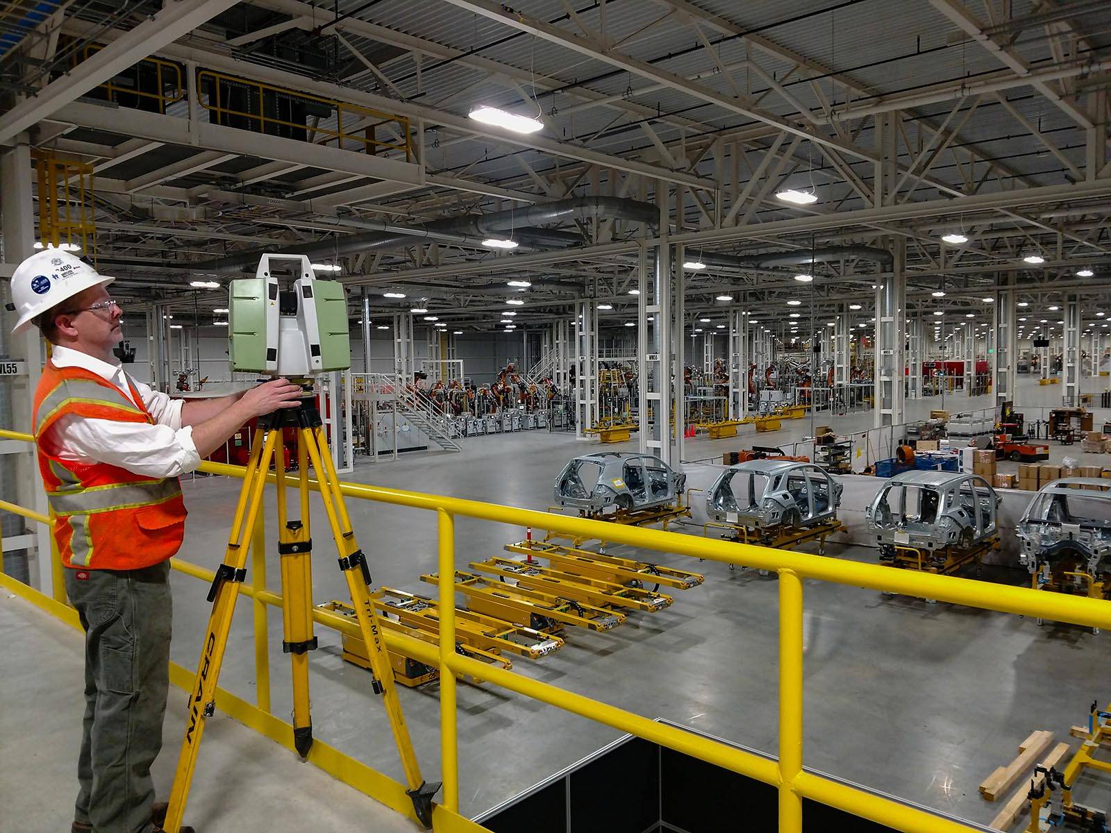
LiDAR scans can be completed in various ways. Depending on the client’s need, Darling Geomatics collects data using terrestrial tripod mounted LiDAR, handheld 3D scanners, and LiDAR equipment mounted on UAVs and airplanes. Drone surveying uses scanners capable of collecting over one million points of data per second, and each scan rotates 360 degrees. Each data point collected contains latitude, longitude, and elevation (the three dimensions referred to in 3D).
The resulting data sets, or point clouds, are put into a project file and imported into the client’s preferred 3D modeling software to create digital twins, maps, and models of any inanimate object: buildings, topography, airplanes, ships, archaeological features, bridges, towers, and more. The measurements are accurate to within millimeters. Specialized 3D scanners used by Darling Geomatics can also achive submillimeter accuracy when needed.
What Does the Future Hold?
As geospatial technology continues to evolve, experts predict that LiDAR will hold the key to developing smart cities and homes, as well as the aforementioned self-driving cars. Wind turbines will become more efficient with the help of LiDAR. All sorts of creative strategies are envisioned for using LiDAR to help control the flow of traffic, the shipment of goods, and the movement of people within a given space. Robotics will lean on LiDAR more and more.
LiDAR is just waiting for the technology to catch up with the ideas.
Interested in Learning More?
Darling Geomatics has over two decades of experience in the surveying industry, serving construction, engineering, mining, energy, airport, healthcare and sports clients worldwide. Trust us for on-time, efficient, accurate, cost effective deliverables every time.

Sign up for our email newsletter to receive updates on the latest in engineering technology that will help improve your projects' efficiency, safety, and costs.
