Language in technical industries rarely changes by accident. When the words professionals use to describe their tools and methods start shifting, it usually means something real is happening underneath - a change in how the work is actually being done, who is doing it, and where the technology is headed.
That is exactly what is happening right now across the UAV and geomatics industries. The long-standing term "unmanned aerial vehicle" and its associated acronym UAV, is quietly giving way to "uncrewed aerial vehicle." Same acronym. Very different meanings. And if you work in aerial surveying, geospatial data collection, or remote sensing, understanding why this shift is happening tells you a lot about where professional drone operations are going.
It Was Never Really About the Man
The obvious critique of "unmanned" has been out there for years. In a field that has steadily diversified its workforce, a term that centers a male operator — even implicitly — started feeling like a relic. The aviation and aerospace communities were among the first to flag this, and organizations like NASA and the FAA began formally transitioning to "uncrewed" in their official communications as far back as 2021.
But the gender critique, while valid, is actually the less interesting reason for the terminology shift. The more substantive argument is technical, not social. "Unmanned" has always implied that the only thing missing from a conventional aircraft is a human pilot sitting in the cockpit. It frames the drone as a diminished version of something else — an airplane without its crew.
That framing made sense in 2005. It does not make as much sense in 2026.
What "Uncrewed" Actually Communicates
The word "uncrewed" does something different. It describes a vehicle that was never designed for human occupation. It is not missing a crew. It was purpose-built to operate without one.
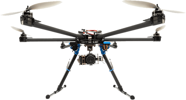
This distinction matters practically in UAV surveying because the design priorities for an uncrewed platform are fundamentally different from those of a piloted aircraft. Weight, flight endurance, sensor payload capacity, autonomous navigation logic, remote command architecture — these are the engineering considerations that define a purpose-built uncrewed system. Framing the platform as "unmanned" subtly positions it within a piloted aircraft paradigm that simply does not apply.
For companies operating in precision surveying, LiDAR data acquisition, photogrammetric mapping, or corridor inspection, this is not an abstract point. The platforms we fly are not simplified airplanes. They are purpose-designed data collection instruments that happen to generate lift. The terminology should reflect that.
The RPAS and UAS Distinction
If "uncrewed aerial vehicle" is the preferred term for the platform, the broader operational context introduces two more terms worth understanding: UAS and RPAS.
A UAS — Uncrewed Aircraft System — refers to the full package: the aircraft, the ground control station, the data links, and all associated support equipment. This is the operationally complete unit that a surveying crew deploys in the field. When Transport Canada, the FAA, or EASA writes regulations, they are almost always regulating the system as a whole, not just the vehicle.
RPAS — Remotely Piloted Aircraft System — is used extensively by ICAO, Transport Canada, and other international bodies to distinguish human-controlled uncrewed aircraft from fully autonomous systems. The "remotely piloted" component matters here because it acknowledges something important: in professional surveying operations, there is still a licensed pilot in the loop. The aircraft is uncrewed, but the operation is not unsupervised.
This distinction is becoming more significant as autonomous and BVLOS (beyond visual line of sight) operations move from experimental permits into standard practice. Understanding the difference between an RPAS — where a pilot maintains active control authority — and a fully autonomous UAS is not just regulatory trivia. It has direct implications for how survey operations are staffed, insured, certified, and legally structured.
Why This Matters for Clients Commissioning Survey Work
If you are a municipality, engineering firm, energy company, or land developer commissioning aerial survey work, the terminology your service provider uses is a reasonable signal of their technical fluency.
A provider fluent in current UAS and RPAS frameworks understands regulatory environments more precisely. They are more likely to hold the appropriate certifications for complex airspace, restricted zones, or BVLOS operations. They are thinking about their platforms as purpose-built data collection systems rather than toys or simplified aircraft.
There is also a data quality argument here. Operators who understand their platform as an uncrewed system — with specific design parameters, sensor integration requirements, and autonomous navigation considerations — tend to produce more consistent, reliable geospatial deliverables. Mission planning, ground control point placement, overlap settings, and post-processing workflows all require a systems-level understanding of how the platform operates. The language a team uses often reflects the depth of that understanding.
The Surveying Industry Is Still Catching Up
Despite the shift happening at the regulatory and aerospace levels, plenty of the surveying and geomatics industry still uses "unmanned" interchangeably with "uncrewed." This is not surprising. Industry terminology does not flip overnight, and the acronym UAV is so deeply embedded in technical literature, software interfaces, and professional certification frameworks that it will be around for a long time regardless of what the U stands for.
The shift also runs into practical inertia. Search behavior still skews toward "UAV survey" and "unmanned aerial survey" in most markets. Project specifications written by engineers trained in the 2010s default to "unmanned." The terminology change is directional, not yet universal.
What this means in practice is that geospatial professionals need to be bilingual — fluent in the legacy terminology that clients and project specifications still use, while operating within the more precise technical frameworks that current platforms and regulations demand.
Autonomous Operations Are Raising the Stakes
The terminology conversation is going to get more urgent as autonomous and AI-assisted drone operations become mainstream in surveying workflows.
When an uncrewed aircraft completes a corridor inspection or a stockpile volumetric survey with minimal real-time pilot input — following a pre-programmed flight plan, adjusting for wind and obstacle avoidance autonomously, and feeding data directly into a processing pipeline — the "remotely piloted" element of RPAS starts to blur. Is the operator piloting, or monitoring? Is the mission flown by the crew or by the software?
These are not philosophical questions. They determine certification requirements, liability frameworks, insurance coverage, and the legal accountability structure for every flight. Getting the language right is one part of getting the operational structure right.
For surveying firms investing in autonomous workflows, LiDAR-equipped fixed-wing platforms, or multi-sensor UAS integrations, the terminology shift from unmanned to uncrewed reflects a maturation in how this industry thinks about itself. The platforms are more capable. The regulatory frameworks are more sophisticated. The professional standards are higher.
The language should match.
A Note on How We Talk About This Work
At Darling Ltd., we have been deliberate about how we describe the systems and methods we use in our survey operations. Precision language is part of precision work. When we describe a platform as an uncrewed aerial system operating within a Transport Canada-approved RPAS framework, we are being accurate in a way that "drone" or "unmanned aerial vehicle" simply does not capture.
That accuracy matters to our clients because it reflects how we approach every other aspect of a project. The terminology you use signals the framework you are working within. In geomatics, where the quality of deliverables depends on the rigor of every step from mission planning to final data product, that framework matters more than most industries appreciate.
The shift from unmanned to uncrewed is a small linguistic change with a clear technical rationale. It acknowledges what modern UAS platforms actually are, respects the regulatory and professional infrastructure that surrounds them, and positions aerial surveying as the precision discipline it has become.
If the words we use to describe our work have not kept pace with the work itself, that is worth correcting.
Sign up for our email newsletter to receive updates on the latest in engineering technology that will help improve your projects' efficiency, safety, and costs.