INDUSTRIES:
Do you need rapid access to large amounts of highly accurate measurable survey data to share with your project team? Our 3D scanning, integrated with conventional airport surveying services allow owners, engineers, construction project managers, and BIM specialists to work off the same digital data, without having to go back and forth to the airport to gather measurements. This rapid 3D scan data acquisition and AutoCAD or easy to use free 3D scan viewing and measuring software (Leica TruView) reduce project costs and schedules. Darling delivers 3D scanning models in AutoCAD, Navisworks, Revit and other professional design software formats. From terminal renovations to cracks and other irregularities on runway surfaces, Darling can measure and document existing conditions at airports, day or night, minimizing impacts to the flow of travelers or aircraft.
Detect Problems Early
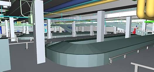
In an airport construction project, designers can detect clash problems with structural, mechanical, electrical, and plumbing systems rapidly with 3D digital data. Conflicts are resolved early in the design process, reducing rework costs during the actual construction.
Time Savings and Accuracy
What used to take weeks or months of surveying, engineering, and architectural drawing now takes days with remote LiDAR scanning.
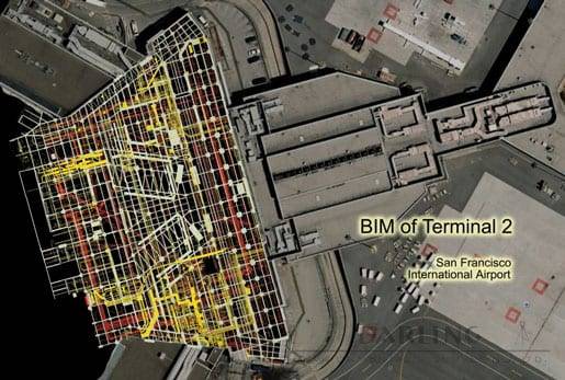
During a complex International Airport reconstruction project, Darling Geomatics performed 3D laser scanning of over 180,000 square feet of an existing terminal. Our method delivered a 3D model to the client that was 10 times more accurate than other methods that could have been used - and delivered in ¼ of the time. Our customer stated that the 3D model saved them over 60 days of design time.

Deliverables in Nearly Any Format
Our company gives airport engineers the freedom to become their own virtual surveyor. Our service includes delivering the data to the engineer in virtually any software they choose, whether it be AutoCAD, Bentley, Point Cloud Data, 3D surface meshes, TruViews or any other mode; allowing them to measure anything from their desks and reduce the need for multiple site visits.

