INDUSTRIES:
Do you need topographic and or color imagery of your golf course? Darling Geomatics specializes in measurement and visualization tools for golf courses. We have been the 3D survey company of choice before PGA tournaments at Beth Page Black, Pebble Beach, Congressional Country Club and Oakmont Country Club.
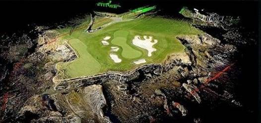
Darling's 3D scanning and aerial drone surveys bring unparalleled accuracy in mapping and photographing depictions of your golf course. We provide detailed information about where water will go, collect or drain so golf course maintenance money is well spent. We take the guesswork out of golf course maintenance or planned improvements you might have in mind. We also provide high resolution true color 3D data for golf apps, aerial videos and measurable orthomosaic photographs of golf courses and more.
Surface and subsurface drainage is critical to successful golf course maintenance. Before you take steps to determine golf course maintenance methods to correct drainage problems on your golf course, let us come in and give you an accurate map to work from.
As the golf course ages and settles, maintenance might be needed; no matter how good the quality of the original golf course plans.
Darling's 3D scanners and drones pick up golf course topography that the eye can miss. We can provide topographic information down to ½” contours on your golf course greens with LiDAR and one-foot topography with drones.
Darling has scanned some of the nation's top golf courses including Pebble Beach, Beth Page Black, Congressional, TPC Sawgrass, Baltistrol and the Ritz. We can deliver results in formats that fit your needs.

