SERVICES:
What Is 3D Scanning? Understanding the Technology and Benefits
3D scanning is the process of capturing the exact size, shape, and surface details of physical objects or environments using high-precision laser technology. At Darling Geomatics, we use advanced terrestrial LiDAR (Light Detection and Ranging) scanners to collect millions of data points with millimeter-level accuracy. The result is a detailed 3D point cloud that can be transformed into models, drawings, or digital twins.
This technology allows us to document existing conditions with unmatched precision—ideal for engineering, construction, historic preservation, and facility management.
Key Differences Between 3D Scanning and Drone Surveying
While both drone surveying and 3D scanning create accurate digital representations, they serve different purposes:
- 3D Scanning – Ground-based, ultra-detailed measurements. Perfect for buildings, interiors, industrial plants, bridges, tunnels, and other structures requiring fine detail.
- Drone Surveying – Aerial data collection. Best for large sites, open terrain, floodplains, stockpiles, or inaccessible areas where speed and coverage are critical.
At Darling Geomatics, we don’t view these as competing technologies but as complementary tools. Drone surveying gives a broad, accurate overview of the landscape, while 3D scanning fills in the fine details of the built environment. Together, they deliver a complete and reliable dataset.
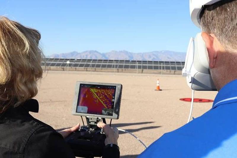
Fast, Cost-Effective 3D Drone Scanning Outperforms Traditional Methods

")
How Darling Clients use 3D Scanning (In the Real World)
Darling Geomatics’ clients use 3D scanning as construction reality capture—a fast, accurate way to measure existing conditions and compare what’s in the field to what was designed. Instead of spot-checking a handful of points, your team gets a dense 3D point cloud (and often a 3D model) that can be reviewed, shared, and measured from the office. That supports better decisions earlier, fewer surprises during construction, and clearer documentation at closeout.
Types of 3D Scanning Technologies (and How Clients Apply Them)
LiDAR (laser-based point clouds)
Clients use LiDAR when they need dependable, geometry-first capture for terrain, structures, and complex surfaces—especially where accuracy matters more than “pretty visuals.” Typical construction and land development uses include topographic surfaces for planning and grading, quantity support for earthwork, roadway/site context, and capturing existing structures for design coordination. LiDAR reality capture is also ideal when you need repeatable datasets for progress comparisons over time.
Terrestrial laser scanning (high-accuracy site and structure capture)
Laser scanning is often the go-to when clients need sub-centimeter detail for buildings, MEP spaces, industrial facilities, or tight tolerances. Common workflows include scan-to-BIM, retrofit planning, renovation documentation, structural measurements, and construction verification where teams want to confirm layout, penetrations, embeds, slab edges, steel alignment, or installed equipment against plans. This is also where teams get huge value from remote measurement—answering questions without sending someone back into the field.
Photogrammetry (drone/camera-based 3D models)
Clients use photogrammetry to cover larger areas quickly—site-wide mapping, stockpile volumes, cut/fill context, corridor progress, and general conditions documentation. It’s especially useful for early planning, ongoing progress visuals, stakeholder communication, and frequent updates across expansive sites. When paired with control and the right workflow, photogrammetry becomes a powerful reality capture layer for schedule tracking and earthwork reporting.
What Clients Actually Do With the Data
Darling’s scanning deliverables are typically used in four repeatable ways:
- Design and preconstruction: Capture existing conditions to reduce RFIs, validate assumptions, and align teams before mobilization.
- Construction verification and QA/QC: Compare the as-built point cloud to CAD/BIM to identify variances early (before they become rework).
- Progress tracking and reporting: Create time-stamped reality capture checkpoints to verify work completed, support pay apps, and document disputes.
- As-builts and closeout: Provide accurate as-is documentation for turnover, facility management, renovations, and future expansions.
Benefits of 3D Scanning
3D scanning delivers unmatched accuracy with sub-centimeter precision to improve project outcomes. It speeds up data collection, reducing field time and cutting costs. Safety improves as scanning minimizes the need for personnel in hazardous environments. High-resolution 3D models enhance visualization, planning, and communication with stakeholders. Overall, 3D scanning streamlines workflows, boosts productivity, and lowers risk on every project.
Our Expertise and Experience in 3D Scanning and Surveying
Darling Geomatics has more than two decades of experience providing cutting-edge surveying solutions. Our team of licensed surveyors and geospatial professionals were early adopters of 3D scanning technology, applying it to projects in:
- Construction – Capturing as-built conditions for clash detection, quality assurance, and design verification.
- Industrial Facilities – Creating 3D models of plants, refineries, and manufacturing sites for maintenance planning and upgrades.
- Historic Preservation – Digitally documenting historic structures to preserve them for restoration and research.
- Healthcare & Sports Facilities – Delivering precise interior scans for renovations, expansions, and safety planning.
Our proven process ensures fast, accurate, and cost-effective deliverables for clients across industries.
Maximizing Results: Combining 3D Scanning with Drone Surveying
The real advantage comes when these two technologies are used together. Drone aerial surveying provides a rapid, wide-area view of terrain and site conditions. 3D scanning then adds fine-grained measurements of structures within that site.
By combining both, we can deliver a complete dataset that supports:
- Full digital twins of facilities and properties
- Seamless integration with BIM and GIS systems
- Accurate planning for infrastructure and utility projects
- Reduced rework, risk, and costly site revisits
Clients gain the confidence that every angle, elevation, and detail has been captured.
Safety and Environmental Compliance
Our 3D scanning solutions support stringent safety and environmental standards. By capturing data remotely, we reduce onsite exposures and safeguard workers. Accurate models help ensure compliance with regulatory requirements and environmental protection plans. Regular scans monitor site conditions for deformation or hazards. We follow industry best practices and local regulations to deliver data that supports safer, greener mining and construction operations.
What You Get from a 3D Survey
Every 3D survey project delivers data in formats that fit your workflow:
- Point clouds - Raw 3D survey data (E57, RCP, LAS) for design software and analysis tools
- CAD drawings - 2D plans, sections, and elevations extracted from 3D survey point clouds
- BIM models - Intelligent 3D models (Revit) for construction coordination and facility management
- Orthomosaic maps - High-resolution aerial imagery georeferenced for GIS and site planning
- Digital twins - Interactive 3D environments for visualization, training, and operations planning
- Mesh models - Textured 3D surfaces for visualization and gaming engine integration
We work with your team to determine which deliverables best support your project goals.
Partner with Darling Geomatics
Whether your project requires ultra-detailed 3D scanning, broad drone-based aerial mapping, or both, Darling Geomatics has the expertise to deliver accurate, actionable results. Our FAA-certified pilots, licensed surveyors, and scanning specialists bring decades of experience to every project.
Work with a partner that understands the technology—and how to combine it for the greatest impact.
Contact Us Today to learn how our 3D scanning services can elevate your project.
3D Survey Frequently Asked Questions
Our Certifications, Licenses & Affiliations
Darling Geomatics is proud to be a member of the following:

