SERVICES:
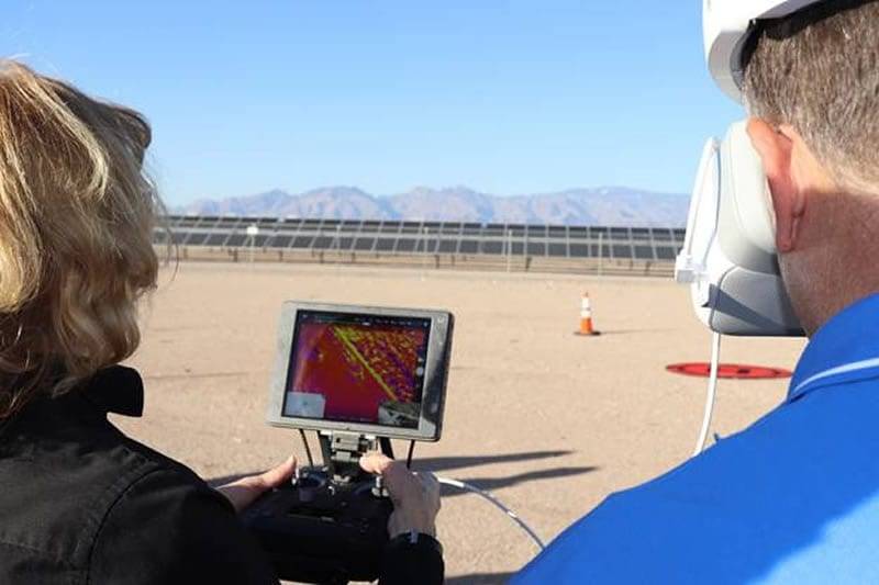
Before a single design decision is made, your team needs to know exactly what exists on site. Darling Geomatics delivers precision 3D construction site surveys using drone LiDAR and terrestrial laser scanning — giving engineers, architects, and project managers a complete, data-rich picture of existing site conditions from day one.
Our pre-construction scanning captures topography, existing structures, utilities, vegetation, and grade in a single mobilization — producing a georeferenced point cloud that feeds directly into AutoCAD Civil 3D, Revit, and other design platforms your team already uses. The result is fewer RFIs, fewer change orders, and a design process built on verified field data rather than assumptions.
Fast, Cost-Effective 3D Drone Scanning Outperforms Traditional Methods
Why Pre-Construction Scanning Matters
Every construction project starts with a set of unknowns. Legacy survey drawings may be years out of date. Site conditions may have changed. Topographic assumptions made during design may not match what's actually in the ground. When those gaps aren't caught until construction begins, they become change orders, schedule delays, and budget overruns.
A 3D pre-construction site survey eliminates the most common sources of that uncertainty. By capturing the existing site in full 3D before design is finalized, your team can identify grade conflicts, document adjacent structures, verify property boundaries, and understand drainage patterns — all from the office, before a single crew is mobilized.
For owners and GCs who've been burned by inaccurate site data before, pre-construction scanning is one of the highest-ROI services available. A scanning mobilization that costs a fraction of a single change order can prevent dozens of them.
What We Capture in a Pre-Construction Site Survey
- Existing topography and grade — Full surface model of the site at sub-centimeter accuracy, suitable for earthwork design and drainage analysis
- Existing structures and buildings — Precise geometry of any structures on or adjacent to the project footprint, including setback and clearance documentation
- Site utilities and infrastructure — Above-ground utilities, access roads, retaining walls, and hardscape documented in full 3D
- Vegetation and tree canopy — Canopy coverage and trunk locations for environmental review, arborist reports, and site planning
- Adjacent property conditions — Documentation of neighboring structures and site features relevant to setback compliance or construction staging
- Georeferenced control network — All data tied to a defined coordinate system for seamless integration with your survey control and design platforms
How Point Cloud Data Feeds Into Your Design Workflow
One of the biggest advantages of 3D site scanning over traditional survey is how the data integrates with modern design software. Rather than receiving a 2D drawing and manually interpreting elevations, your design team receives a full georeferenced point cloud that can be imported directly into:
- Autodesk Civil 3D — Generate existing surface models, contours, and cross-sections directly from the point cloud for earthwork design and grading plans
- Autodesk Revit — Link the point cloud as an underlay for architectural and structural design, with accurate reference geometry at every elevation
- AutoCAD — Use point cloud data as a precise drafting reference for site plans, utility layouts, and construction documents
- Navisworks — Combine the scanned site model with your design BIM for early clash detection and constructability review
- Bentley MicroStation / OpenRoads — Full compatibility for infrastructure and civil engineering workflows
Darling delivers scan data in .RCP/.RCS (Autodesk), .LAS/.LAZ, and .E57 formats — covering every major design platform used in construction today. We also include a coordinate system summary and scan coverage report so your team can begin working immediately without back-and-forth on data setup.
Our Pre-Construction Scanning Process
Step 1 — Project Scoping
We review your project drawings, site address, and deliverable requirements to determine the appropriate scanning methodology — drone LiDAR for large open sites, terrestrial laser scanning for tight urban sites or structures, or a hybrid of both for complex projects.
Step 2 — Field Mobilization & Capture
Our licensed geomatics team deploys to site and captures the full project area in a single mobilization. For most sites under 5 hectares, capture is completed in one day. Drone LiDAR surveys can cover significantly larger civil sites in the same timeframe.
Step 3 — Point Cloud Registration & Processing
Raw scan data is registered, cleaned, and georeferenced in our office. Ground control points are applied to ensure survey-grade positional accuracy throughout the dataset.
Step 4 — Deliverable Production & QA
We produce your requested deliverables — point cloud, surface model, topographic drawing, or existing conditions plan — and run internal QA review before handoff. Standard turnaround is 5–7 business days from site capture.
Related Scanning Services
Pre-construction scanning is the starting point — but Darling supports your project through every phase that follows:
- Earthwork Volume Calculation with LiDAR — Once design is underway, use drone LiDAR to compute accurate cut/fill volumes and verify grading progress
- Scan to BIM — Convert your pre-construction point cloud into a coordinated BIM model for design and MEP coordination
- 3D Scanning for Renovation Projects — For projects involving existing buildings, as-built scanning ensures your design is built on verified geometry.
- View all 3D Scanning Services →

Our Certifications, Licenses & Affiliations
Darling Geomatics is proud to be a member of the following:

