SERVICES:
When a structure needs to be assessed, the quality of the inspection is only as good as the quality of the data behind it. Traditional structural inspection relies on manual measurement, visual observation, and spot checks — methods that are time-consuming, subjective, and incapable of capturing the full geometric picture of how a structure has moved, settled, or deteriorated over time.
Darling Geomatics provides structural inspection and documentation services using 3D laser scanning — capturing complete, millimeter-accurate geometry of existing structures in a single non-destructive mobilization. Whether you're assessing a building for renovation, documenting deformation in a retaining wall, evaluating settlement in a slab, or establishing a baseline condition record for an aging facility, our scanning delivers the objective, defensible data your engineers and owners need to make confident decisions.
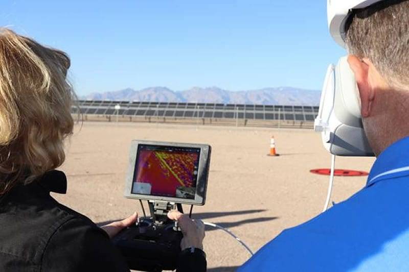
Fast, Cost-Effective 3D Drone Scanning Outperforms Traditional Methods
Structural Inspection & Documentation with 3D Scanning
When a structure needs to be assessed, the quality of the inspection is only as good as the quality of the data behind it. Traditional structural inspection relies on manual measurement, visual observation, and spot checks — methods that are time-consuming, subjective, and incapable of capturing the full geometric picture of how a structure has moved, settled, or deteriorated over time.
Darling Geomatics provides structural inspection and documentation services using 3D laser scanning — capturing complete, millimeter-accurate geometry of existing structures in a single non-destructive mobilization. Whether you're assessing a building for renovation, documenting deformation in a retaining wall, evaluating settlement in a slab, or establishing a baseline condition record for an aging facility, our scanning delivers the objective, defensible data your engineers and owners need to make confident decisions.
The Case for Scan-Based Structural Assessment
A structural engineer performing a manual condition survey can measure specific points, photograph visible defects, and record observations — but they cannot efficiently measure the full three-dimensional shape of a structure, quantify how much a column has deviated from plumb, or document precisely where a floor slab has deflected and by how much. Those limitations aren't a reflection of the engineer's capability — they're a reflection of what manual methods can physically capture.
3D laser scanning removes those limitations entirely. A scanner positioned at multiple locations throughout a structure captures millions of georeferenced data points across every surface it can see — columns, beams, walls, slabs, facades, and connections — producing a complete geometric record of the structure as it currently exists. That record can be compared against design intent, against previous scan campaigns, or against engineering tolerance thresholds to quantify deformation, movement, and deterioration with a level of precision and spatial completeness that manual methods simply cannot match.
For facility owners managing aging infrastructure, this changes the nature of the inspection conversation. Rather than working from an engineer's field notes and photographs, decisions about repair, remediation, and capital planning are made from a complete, measurable 3D model of the structure — one that can be revisited, re-analyzed, and compared against future surveys without returning to site.
Structural Conditions We Document
Deformation and Out-of-Plumb Assessment
Columns, walls, and structural frames are measured for deviation from vertical and from their design geometry — quantifying lean, bow, and distortion across the full height of the element with sub-centimeter precision. Critical for buildings that have experienced foundation movement, seismic activity, or long-term creep.
Slab Deflection and Floor Flatness
Floor slabs are scanned to produce full surface models showing deflection patterns, settlement bowls, and flatness deviations — including F-number analysis where required for industrial flooring, warehouse operations, or equipment installation tolerances.
Facade and Cladding Condition
Exterior building envelopes are scanned to document bulging, bowing, cracking patterns, and displacement in cladding systems, masonry facades, and curtainwall panels — capturing conditions across the full facade elevation without the cost of scaffolding or aerial lift access for most building heights.
Retaining Wall and Slope Movement
Retaining structures, slope faces, and earth-retaining systems are scanned to document current geometry and, on repeat campaigns, to quantify movement over time. Particularly valuable for infrastructure owners managing walls with known movement history or adjacent to active construction.
Structural Connection Documentation
Connections, bearing conditions, and interface geometry are documented at their as-built dimensions — useful for engineers assessing load path integrity, reviewing historic modifications, or designing retrofits that must connect to existing structure.
Heritage and Historic Structure Documentation
Complete geometric documentation of heritage buildings and historic structures where non-contact measurement is required to protect fabric integrity. Scanning produces a permanent digital archive of the structure's geometry that supports conservation planning, heritage designations, and restoration design.
Post-Event Condition Documentation
Rapid structural documentation following flood, fire, seismic, vehicle impact, or other damaging events — establishing a verified record of post-event conditions for insurance claims, engineering assessment, and legal documentation.
How Scanning Supports the Full Inspection Workflow
3D scanning is not a replacement for structural engineering judgment — it's the data layer that makes that judgment more accurate, more defensible, and more efficiently applied. The typical workflow for a scan-supported structural inspection looks like this:
Mobilization and Capture
Our team deploys to the structure and scans all areas of interest in a single mobilization — interior and exterior as applicable. Access requirements are discussed in advance, including areas above ceilings, in confined spaces, or at height. For most mid-sized commercial buildings, capture is completed in one day.
Point Cloud Registration and Processing
Scan stations are registered into a unified georeferenced point cloud. The dataset is cleaned and prepared for analysis — with all scan stations tied to a consistent coordinate system so that measurements taken anywhere in the dataset are directly comparable.
Geometric Analysis and Deviation Mapping
Where your engineering team has specified analysis parameters — plumb tolerances, deflection limits, flatness thresholds — we perform geometric analysis against those parameters and produce deviation maps showing where the structure falls inside and outside tolerance. Results are visualized as color-coded deviation plots overlaid on the point cloud or surface model.
Deliverable Production
Final deliverables are configured to your engineering team's workflow — point cloud for direct analysis, deviation maps and reports for condition assessment documentation, or a structural BIM model for integration with renovation or retrofit design. See deliverable options below.
Repeat Campaign Comparison
For structures being monitored over time, each new scan campaign is registered to the same coordinate system as the baseline survey — enabling direct geometric comparison between campaigns to quantify movement and change. This is the foundation of a scan-based structural monitoring program.
Deliverable Options for Structural Inspection
Registered Point Cloud
The complete georeferenced 3D dataset in .RCP/.RCS, .LAS/.LAZ, or .E57 format — for engineering teams who work directly with point cloud data in analysis or design software.
Deviation Analysis Report
Color-coded deviation maps showing measured geometry against design intent or tolerance thresholds, with tabular summary of out-of-tolerance conditions. Delivered as PDF with supporting data files. Most common deliverable for condition assessment and engineering review.
2D Documentation Drawings
Measured floor plans, elevations, and sections extracted from the point cloud — showing actual as-built geometry at defined survey accuracy. Suitable for renovation design, heritage documentation, and structural assessment reports.
Structural As-Built BIM Model
A Revit BIM model of the structure built from the point cloud at LOD 300–350 — for projects where the inspection feeds directly into renovation design, retrofit engineering, or facilities management. See our Scan to BIM services for full scope and LOD options.
Monitoring Program Reports
For repeat-campaign monitoring programs, periodic reports comparing current geometry against baseline — documenting movement, change rate, and trend direction over time. Formatted for engineering review and owner reporting.
Structural Scanning for Renovation Projects
Structural inspection scanning and renovation scanning are closely related services — and on many projects, they're scoped together in a single mobilization. When a facility owner or GC is preparing for a significant renovation, the structural inspection scan serves two purposes simultaneously: it documents condition concerns that need to be addressed before renovation, and it produces the as-built geometry the design team needs to work from.
If your project involves both assessing existing structural conditions and preparing for renovation design, combining both scopes in a single site visit is the most cost-effective approach. Our team can capture full as-built geometry for design use while also producing the deviation analysis and condition documentation your structural engineer needs — one mobilization, two deliverables.
Learn more about 3D Laser Scanning for Renovation Projects →
Related Scanning Services
- 3D Scanning for Renovation Projects — Full as-built documentation for renovation scope, often combined with structural inspection in a single mobilization for maximum efficiency
- Scan to BIM Services — Convert your structural inspection point cloud into a coordinated BIM model for retrofit design, renovation coordination, or facilities management
- Pre-Construction Site Survey — For new construction adjacent to existing structures, document neighboring building conditions before work begins to establish a pre-construction baseline for vibration and settlement monitoring
- View all 3D Scanning Services →

Our Certifications, Licenses & Affiliations
Darling Geomatics is proud to be a member of the following:

