Posts by Mary Darling
Survey Errors & Boundary Disputes: How Surveyors Fix Them
Survey Errors, Discrepancies, and Boundary Disputes: What Causes Them and How Professional Surveyors Resolve Them Anyone who has spent time in the land surveying profession knows this to be true: no two parcels tell exactly the same story. Title documents say one thing, physical monuments say another, and the neighbor’s fence sits somewhere in between.…
Read MoreUncrewed vs. Unmanned: Why UAV Terminology Matters in Surveying
Uncrewed vs. Unmanned: Why the Terminology Shift in UAV Surveying Matters More Than You Think Language in technical industries rarely changes by accident. When the words professionals use to describe their tools and methods start shifting, it usually means something real is happening underneath – a change in how the work is actually being done,…
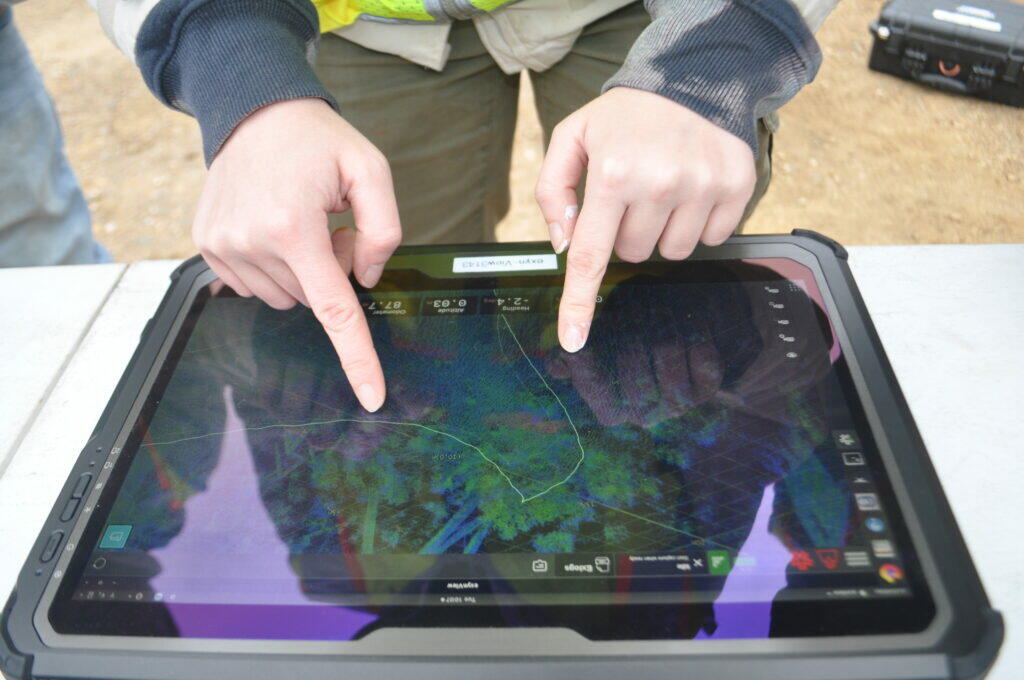
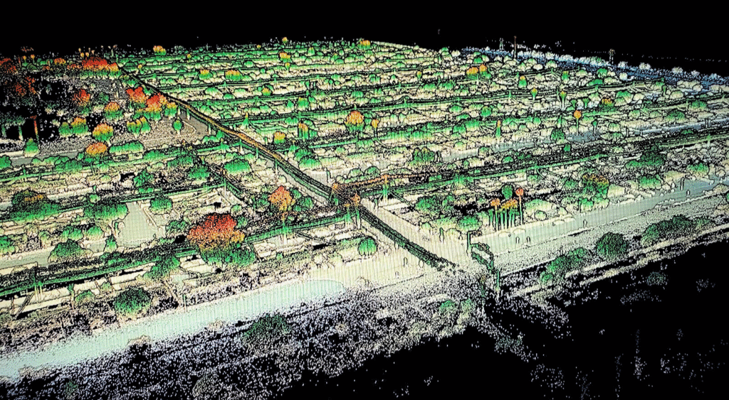
Read MoreMore Ground, More Accuracy: How Aerial LiDAR and Photogrammetry Are Redefining Large-Scale Topographic Surveys
More Ground, More Accuracy: How Aerial LiDAR and Photogrammetry Are Redefining Large-Scale Topographic Surveys The Changing Landscape of Site Planning Decades ago, mapping a massive parcel of land meant sending crews out for weeks. They would hike through rough terrain, setting up equipment and recording points one by one. It was a slow and physically…
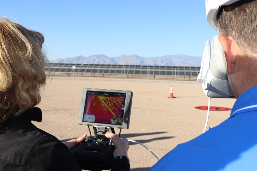
Read MoreUAV Thermal Imaging: Fast, Safe Building Envelope Analysis for Factories and Commercial Buildings
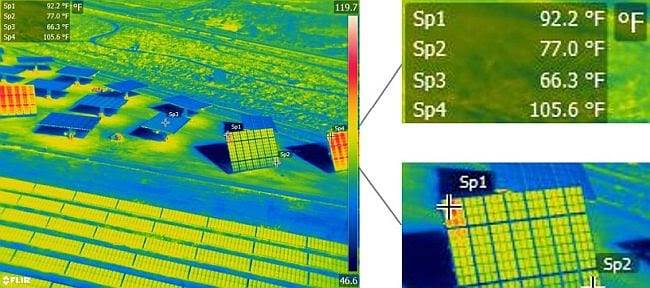
UAV Thermal Imaging: Fast, Safe Building Envelope Analysis for Factories and Commercial Buildings Building owners face a persistent challenge. Energy costs consume substantial operational budgets while aging building envelopes deteriorate invisibly behind walls and above ceilings. Traditional inspection methods require scaffolding, building access equipment, and production shutdowns that cost more than the inspections themselves. Meanwhile,…
Read MoreMetrology in Industrial Facilities: Ensuring Precision for Factories and Manufacturing Plants
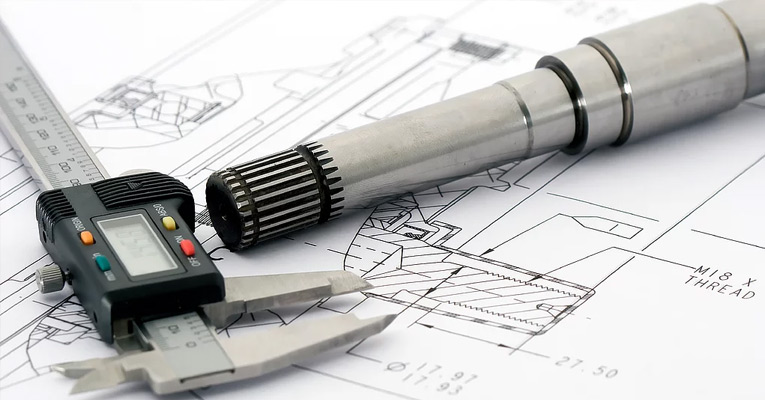
Metrology in Industrial Facilities: Ensuring Precision for Factories and Manufacturing Plants Modern manufacturing success depends on measurement precision measured in microns. A single misaligned component can halt production lines for hours. Dimensional deviations of millimeters cascade into quality failures costing thousands in scrap and rework. In this environment, industrial metrology has evolved from occasional verification…
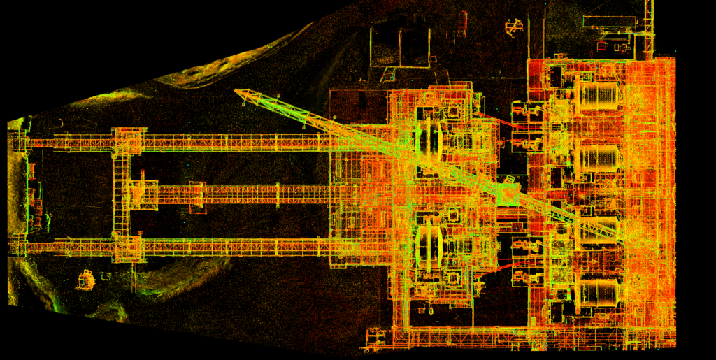
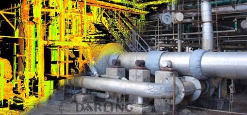
Read MoreCreating Accurate Digital Twins with LiDAR Scanning: A Step-by-Step Guide
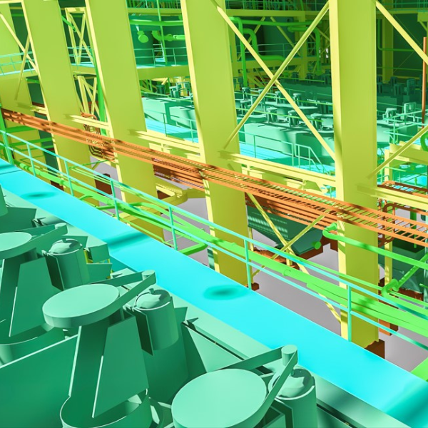
Creating Accurate Digital Twins with LiDAR Scanning: A Step-by-Step Guide A digital twin is more than a 3D model. It’s a living, data-rich replica of a physical asset that supports real-time decision-making, predictive maintenance, and operational planning. The foundation of any useful digital twin is accurate geometry, and that’s where LiDAR scanning comes in. LiDAR…
Read MoreWhat are reality capture and digital twins anyway?
What are reality capture and digital twins anyway? If you’ve been in manufacturing project management for more than a few months lately, you’ve probably heard someone mention reality capture or digital twins in a meeting. Maybe it was during a facility expansion discussion, or when someone was trying to solve a clash detection problem. These…
Read MoreTop 7 Benefits of Using Drones for Land Surveys – Speed, Savings and Superior Data
Top 7 Benefits of Using Drones for Land Surveys – Speed, Savings and Superior Data The land surveying industry has changed dramatically over the past decade. What used to take weeks of manual fieldwork can now be accomplished in a matter of hours. Drone surveying has emerged as a game-changer for professionals who need accurate,…
Read MoreWhen Is an As-Built Survey Needed? Complete Requirements Guide
When Is an As-Built Survey Needed? Complete Requirements Guide Construction projects rarely go exactly as planned. Regulations change, lenders impose new requirements, and municipalities demand documentation you never saw coming. Understanding when an as-built survey becomes necessary can save your project from costly delays and compliance issues. At Darling Geomatics, we see the same question…
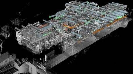
Read More3D Scanning Services That Redefine Accuracy: How Darling Geomatics Captures Every Detail
3D Scanning Services That Redefine Accuracy: How Darling Geomatics Captures Every Detail 3D scanning has transformed the way projects are planned, designed, and built. Instead of relying on limited measurements and drawings, engineers, architects, and developers now have access to highly detailed digital models that mirror reality. At Darling Geomatics, our 3D scanning services deliver…
Read More