Archive for August 2018
Drone Surveys for 3D Flood Simulations
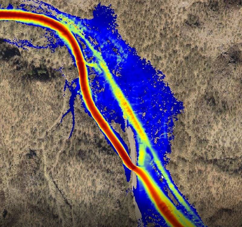
Drone Surveys for 3D Flood Simulations Our drone surveying and mapping services provide surveying and mapping services provide hydrologists, engineers and others with accurate digital data for flood stage calculations, topographical maps, and 3D visualizations, reducing the risk of design errors, lowering project costs and improving safety: High-flow simulations: 3D digital data is used for high-flow…
Read More