Archive for March 2021
Darling Geomatics Wins Contract to Provide High Tech Forensic Assessments Using Drones and LiDAR
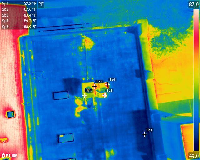
Darling Geomatics Wins Contract to Provide High Tech Forensic Assessments Using Drones and LiDAR We have been selected by a national forensics company to provide our drone survey and LiDAR scanning expertise to produce digital maps and models used in exhibits for the accident and criminal investigations throughout the southwest US for five years. “The 3D…
Read More