Skip to content
Our Registered Land Surveyors (RLS) Now Licensed in Seven States — Arizona, New Mexico, Nevada, South Dakota, Minnesota, Wisconsin, and Oregon!
Learn More
Darling Geomatics
  • Services
    • Drone LiDAR Scanning
    • Digital Twins
    • Drone Surveying
    • Hyperspectral and LiDAR Imaging
    • Land Surveying
    • Thermal Imaging
    • Mine Surveying and Mine Claim Staking
    • Environmental Consulting
    • Metrology
    • Easements
  • Industries
    • Aerospace & Aviation
    • Civil Engineering & Infrastructure
    • Construction & Land Development
    • Sports & Recreational Facilities
    • Healthcare & Medical Facilities
    • Manufacturing & Industrial Sites
    • Mining & Natural Resources
    • Renewable Energy & Power
  • Applications
    • ALTA Surveys
    • BIM and As-Built Experts
    • Construction Verification
    • Digital Twins with AI
    • Historical Preservation
    • Mining Claim Staking
    • Tank Settlement Surveys
    • UAV Photogrammetry
    • 3D Drone Topography, UAV Photogrammetry and LiDAR Services
    • LiDAR Tunnel Scanning
    • Solar Power Plant Inspection
    • Underground Mine Scanning with Drones
  • Case Studies
    • Manufacturing Plant Case Study
    • US Navy Case Study
    • Airport Case Study
    • Mining LiDAR Hyperspectral Imaging Case Study
    • Digital Twins Speed up Return of Dormant Mine to Full Operation
    • Using Drones + LiDAR to Map 3D Models of a Gold Mine
    • Topographic Mapping for Solar Development
    • Advanced Metrology Solutions for Power Generation
  • About Us
    • Our Team
    • Awards
    • Supplier Diversity Certifications
    • In the News
    • Featured Videos
    • Events
    • Conference Presentations
    • Jobs
    • Contact Us
    • Subscribe
  • Blog
  • Request a Proposal
  • Menu Item

Archive for October 2024

Digital Twins, LiDAR Scanning, and AI: A Powerful Combination for Industry 4.0

By Mary Darling | October 30, 2024

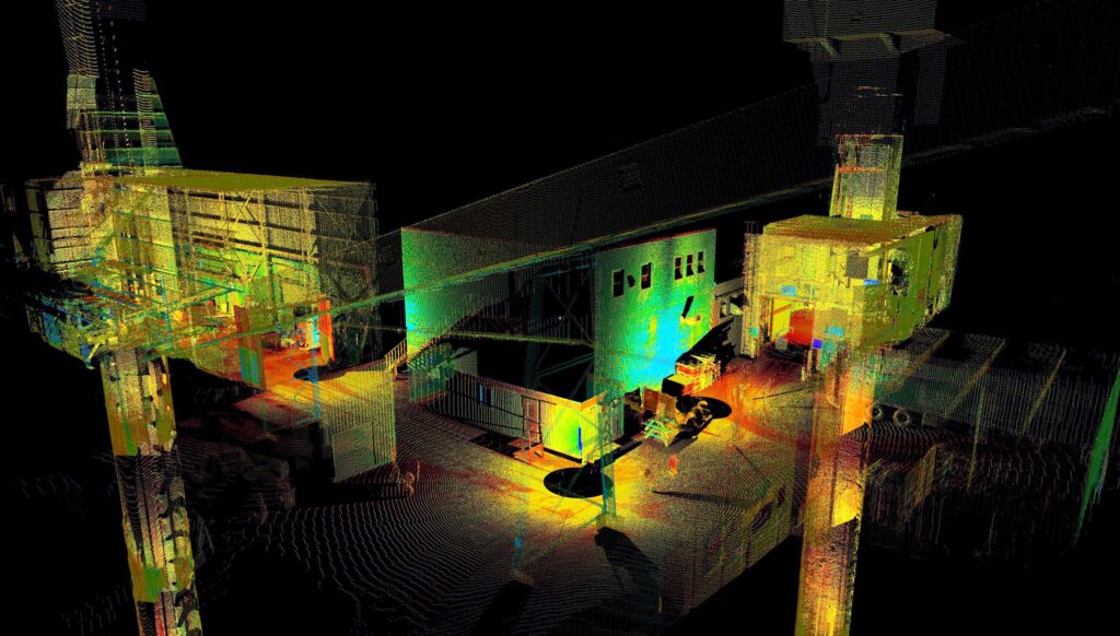
Discover how digital twins—virtual representations of real-world objects or processes—provide risk-free environments for simulation, monitoring, and predictive capabilities across industries like construction, manufacturing, transportation, mining, and healthcare.

Read More
Recent Posts

  • Living Blueprints: Why 2025 Is the Breakout Year for Digital Twins
  • Land Survey Party Chief
  • Top FAQs About Drone Surveying – Darling Geomatics
  • The Importance of Accurate Land Surveys in Arizona’s Mining Industry
  • What is the difference between Hyperspectral Imaging and LiDAR?

Recent Comments

    Archives

    • August 2025
    • July 2025
    • April 2025
    • March 2025
    • February 2025
    • January 2025
    • November 2024
    • October 2024
    • September 2024
    • August 2024
    • July 2024
    • June 2024
    • May 2024
    • April 2024
    • March 2024
    • February 2024
    • January 2024
    • December 2023
    • November 2023
    • October 2023
    • September 2023
    • August 2023
    • July 2023
    • June 2023
    • May 2023
    • April 2023
    • January 2023
    • December 2022
    • November 2022
    • October 2022
    • September 2022
    • August 2022
    • June 2022
    • March 2022
    • February 2022
    • January 2022
    • December 2021
    • November 2021
    • October 2021
    • August 2021
    • July 2021
    • April 2021
    • March 2021
    • January 2021
    • October 2020
    • September 2020
    • August 2020
    • May 2020
    • March 2020
    • February 2020
    • November 2019
    • October 2019
    • September 2019
    • July 2019
    • June 2019
    • March 2019
    • February 2019
    • January 2019
    • October 2018
    • August 2018
    • May 2018

    Categories

    • Arizona
    • Blog
    • Events
    • Jobs
    • mine mapping
    • Past Events
    • Upcoming Event

    Meta

    • Log in
    • Entries feed
    • Comments feed
    • WordPress.org
    logo-white.svg
    • About Us
    • Contact Us
    • Subscribe
    • Blog
    • Frequently Asked Questions
    • Terms Of Use
    • Privacy Policy
    • Arizona LiDAR Trailblazers

    Main Office: (520) 298-2725

    Fax: (520) 298-2767

    University of Arizona Science and Technology Park
    9040 South Rita Road, Suite #2350
    Tucson, AZ 85747

    NAICS: 541370, 541340, 541512, 541922, 541620, 541690, 541990
    Cage Code: 3CGJ9
    D&B: 884625562

    © 2025 Darling Geomatics. All Rights Reserved.