Posts by Mary Darling
Largest Tech + Business Expo in Southern Arizona
Join us and over 400 business and tech leaders to learn what’s new and trending across Southern Arizona’s tech industries including transportation, automation, optics, biotech, mining, aerospace, defense, logistics, robotics, space exploration, IT and more.
Read More2023 SME Annual Conference
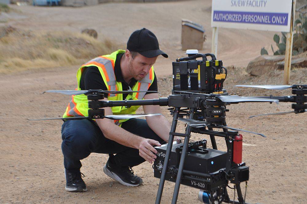
Darling Geomatics will discuss heavy lift drones for hyperspectral and LiDAR mapping including a discussion about spectral libraries; swarm drones, AI/ML and real time data; plus reveal a revolutionary patented rotational anisotropic material with tunable dielectric responses that eliminates thermal distortion, making miniaturization of drones, sensors and batteries possible.
Read MoreThe Guide to Mine Surveying
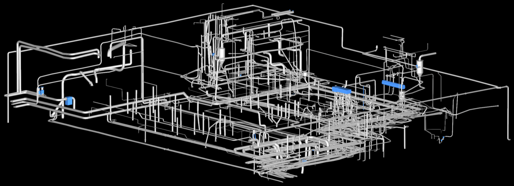
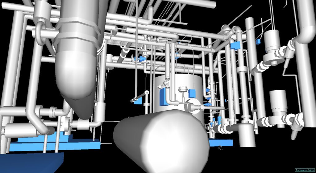
Innovations in mine surveying made possible by state-of-the-art survey technologies have revolutionized mine design and development, environmental and safety monitoring, and volumetric calculation.
Read MoreGuide to Hyperspectral Imaging
Hyperspectral imaging, also known as imaging spectroscopy, refers to the gathering and processing of data from across the vast electromagnetic spectrum.
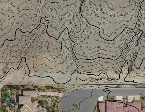
Read MoreWhen to Use Aerial LiDAR
Modern aerial LiDAR equipment mounted on UAVs makes possible the collection of high resolution elevation data used to create 3D models of objects, detailed Digital Terrain Models (DTMs), and Digital Elevation Models (DEMs).
Read MoreMary Darling Serves as Ambassador at Goldman Sachs Small Businesses Summit

Mary Darling, Darling Geomatics CEO and Principal Owner, will serve as an Arizona ambassador at Goldman Sachs 10,000 Small Businesses Summit to be held July 18-20 in Washington, D.C. The Summit will be the largest gathering of small business owners in the U.S.
Read MoreLiDAR Explained
After much waiting, LiDAR’s day has finally come, and we have an array of software platforms powerful enough to handle the huge amounts of data generated by LiDAR scans.
Read MoreLand Surveying with Drones: Transforming Accuracy and Efficiency
Drones collect raw data, giving drone surveyors the opportunity to work with an unimaginable volume of images and measurements that can then be downloaded and used.
Read MoreLand Surveying Mistakes Can be Dangerous
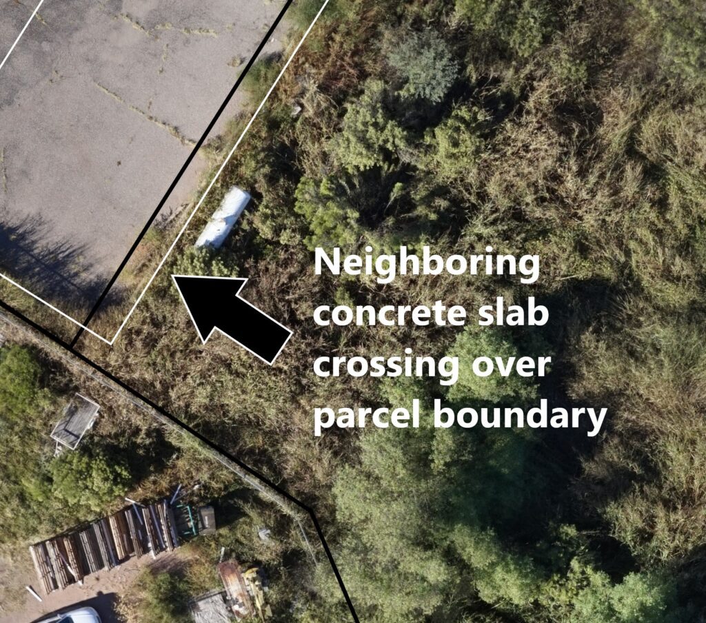
Land surveying mistakes cause problems that reverberate for years to come, costing time, money, and peace of mind.
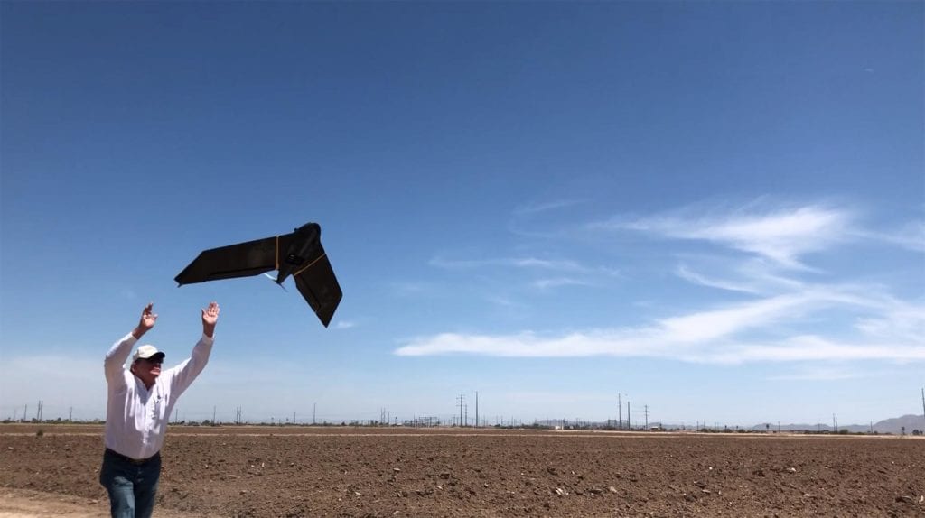
Read MoreDarling Geomatics Soars into Summer 2021
Darling Geomatics Soars into Summer 2021 While others wilted from the summer heat, Darling Geomatics roared into summer 2021, and the news is all sunny. First, the acquisition of a new high tech vertical take-off and landing (VTOL) fixed-wing drone has pilots and customers buzzing. Because this type of drone can go straight up and…
Read More