Blog
When Is an As-Built Survey Needed? Complete Requirements Guide
When Is an As-Built Survey Needed? Complete Requirements Guide Construction projects rarely go exactly as planned. Regulations change, lenders impose new requirements, and municipalities demand documentation you never saw coming. Understanding when an as-built survey becomes necessary can save your project from costly delays and compliance issues. At Darling Geomatics, we see the same question…
Read More3D Scanning Services That Redefine Accuracy: How Darling Geomatics Captures Every Detail
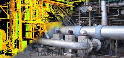
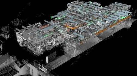
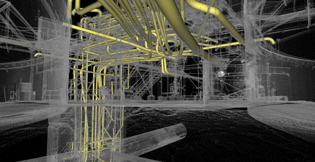
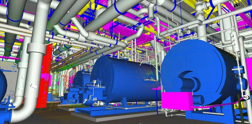
3D Scanning Services That Redefine Accuracy: How Darling Geomatics Captures Every Detail 3D scanning has transformed the way projects are planned, designed, and built. Instead of relying on limited measurements and drawings, engineers, architects, and developers now have access to highly detailed digital models that mirror reality. At Darling Geomatics, our 3D scanning services deliver…
Read MoreDarling Geomatics Awarded On-Call Land Surveying Contract for the City of Tucson
Darling Geomatics Awarded On-Call Land Surveying Contract for the City of Tucson Tucson Continues to Grow Darling Geomatics is proud to announce that we have been awarded the 2025-2026 on-call land surveying contract for the City of Tucson. This award highlights our decades of experience, dedication to precision and safety, and commitment to supporting the…
Read MoreLiving Blueprints: Why 2025 Is the Breakout Year for Digital Twins
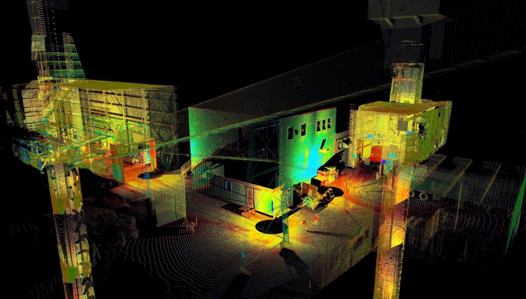
Living Blueprints: Why 2025 Is the Breakout Year for Digital Twins For years, the concept of a digital twin sounded futuristic: something reserved for aerospace labs or advanced manufacturing plants. But in 2025, that’s changed. Digital twin technology is rapidly becoming essential for construction sites and industrial property management. Today’s digital replicas are more than…
Read MoreTop FAQs About Drone Surveying – Darling Geomatics

Drone Surveying FAQs: Everything You’ve Wanted to Ask (But Didn’t Know Who to Ask) Drone surveying is revolutionizing the world of geospatial data collection, but for many engineers, developers, and project managers, it remains a mystery. In this blog, we tackle the most frequently asked questions about drone surveying — the ones people hesitate to…
Read MoreThe Importance of Accurate Land Surveys in Arizona’s Mining Industry
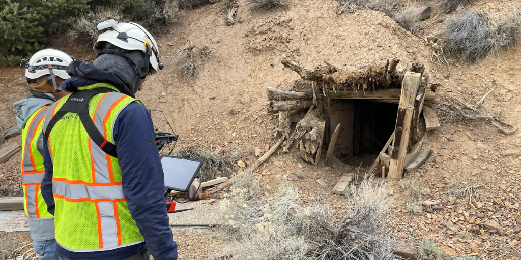
The Importance of Accurate Land Surveys in Arizona’s Mining Industry Mining has been a cornerstone of Arizona’s economy for over a century, producing copper, gold, silver, and a range of other minerals critical to industries worldwide. But behind every successful mining operation is a foundation of precise, detailed land surveying. At Darling Geomatics, we understand…
Read MoreHyperspectral Imaging vs LiDAR: What’s the Difference?
Hyperspectral Imaging vs LiDAR: What’s the Difference? Hyperspectral imaging and LiDAR represent two of the most powerful remote sensing technologies available today. While hyperspectral sensors capture detailed spectral signatures across hundreds of wavelengths to identify materials, LiDAR uses laser pulses to create precise 3D terrain models. Understanding when to deploy each technology—or combine them—is critical…
Read MoreThe Future of Reality Capture: How LiDAR Scans and 3D Scanning are Transforming Industries
The Future of Reality Capture: How LiDAR Scans and 3D Scanning are Transforming Industries In recent years, the advancement of LiDAR systems and 3D scanning technology has revolutionized several industries by providing highly accurate, high-resolution data and models. LiDAR, which stands for Light Detection and Ranging, utilizes laser light to measure distances and generate detailed…
Read MoreSeeing Below the Surface: How 3D Laser Scanning is Revolutionizing Mine Surveying
Seeing Below the Surface: How 3D Laser Scanning is Revolutionizing Mine Surveying Let’s talk about something exciting that’s transforming the mining industry: 3D laser scanning technology. If you’re involved in mining operations, you know how crucial it is to understand both your surface and underground environments. What if I told you there’s a way to…
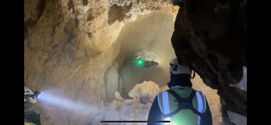
Read MoreNext-Generation Underground Mapping: LiDAR Applications in Complex Mine Networks
Next-Generation Underground Mapping: LiDAR Applications in Complex Mine Networks The evolution of underground mapping technology has transformed how we understand and navigate complex mine networks. Through the integration of LiDAR (Light Detection and Ranging) technology, geological surveys have reached unprecedented levels of accuracy and detail, revolutionizing how we approach underground mine mapping projects. The Power…
Read More