Blog
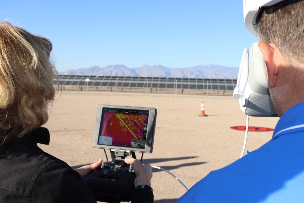
Thermal Imaging UAVs for Solar Plant Inspections
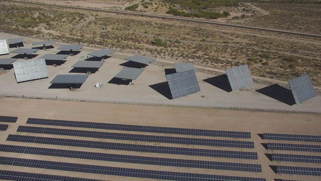
Our aerial thermography for solar panel field evaluations provides data on efficiencies of power generation, panel service life, and return on the investment. Our FLIR-equipped UAVs with Zenmuse XT 640×512 resolution radiometric infrared camera lowers the cost of services that would otherwise require a helicopter.
Read MoreSupplier Diversity Certifications
Federal and state governments set goals of awarding certain percentages of prime and subcontracting dollars to businesses to proactively develop and expand supplier diversity. Our certifications help our clients and teaming partners meet these supplier diversity requirements.
Read More3D Structural Assessment of Plant Before Modifications
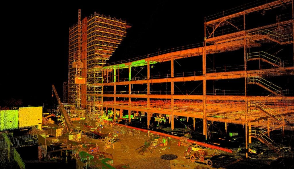
3D Structural Assessment of Plant Before Modifications Do you know if your facility meets structural integrity standards before you invest in renovations or modifications? 3D scanning for manufacturing delivers accurate as-built models to assist in project planning and assessment. Safe, fast and accurate 3D as-built models can be used to detect structural deficiencies and design…
Read More1.5 Million Square Feet and Billions of Data Points in Just Eight Days
Do you know how we scanned a 1.5 million square foot Mercedes-Benz facility for construction verification in just eight days? Advances in 3D scanning technologies and data analysis software have set a new standard in intelligence for facility owners, architects, engineers and contractors. Read this xyHt magazine article for details.
Read MoreMaking Airlines Safer Through Innovation
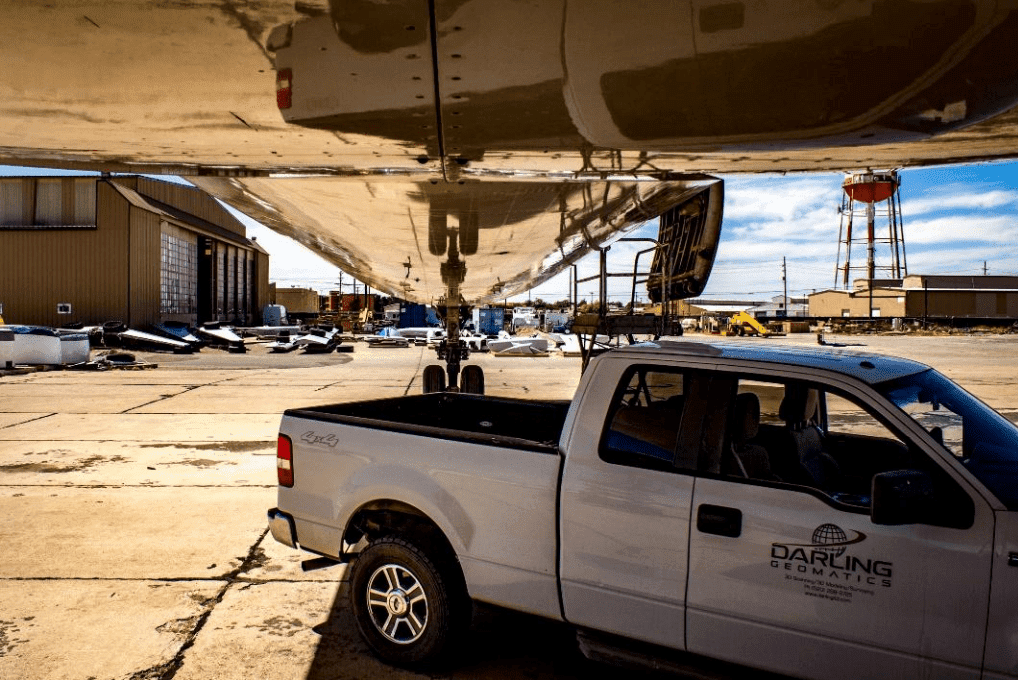
Making Airlines Safer Through Innovation Whenever we have the privilege of working with a company that saves lives, we get excited. In the case of airline safety – we have had the opportunity to be part of a team that designs and installs baffling systems inside the fuel tanks of airlines. The baffling part to…
Read MoreDrone Topographic Mapping Fills the Efficiency Gap
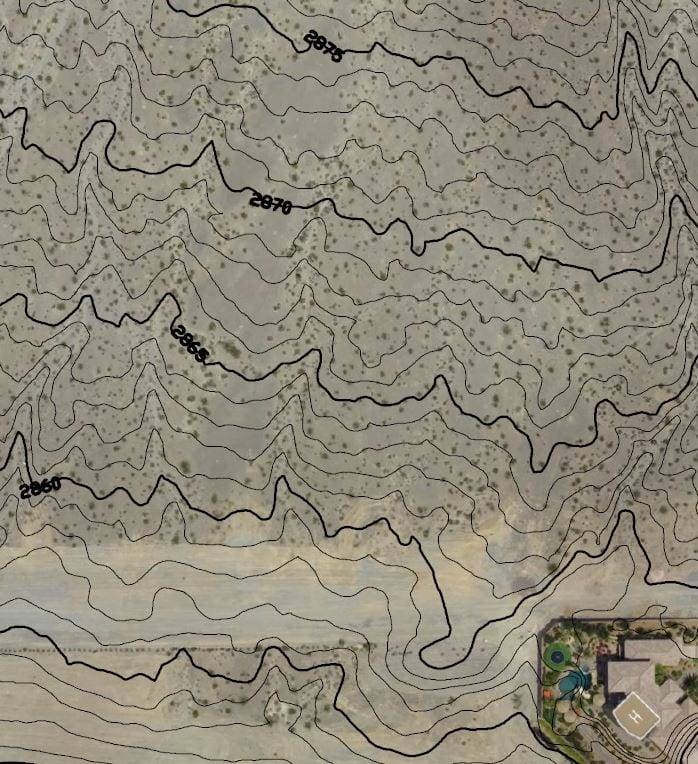
Does your project success depend on accurate ground characteristics? Professional engineering quality topographic maps reduce risk and uncertainty by accurately depicting slopes, undulations, water flow and hazards necessary to design and planning. Drones supplement ground crews and replace manned aircraft, reducing time and cutting costs of producing topographic maps.
Read MoreEnergy Audits and Building Inspections Using Drones
Energy Audits and Building Inspections Using Drones Do you wonder why your heating and air conditioning bills are high? Our energy audits use infrared thermal imaging from a drone to provide facility owners with accurate, actionable information to correct energy loss, imbalances, and inefficiencies. Do you worry about the condition of your roof after storms?…
Read MoreDrone Surveys for 3D Flood Simulations
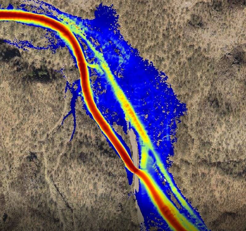
Drone Surveys for 3D Flood Simulations Our drone surveying and mapping services provide surveying and mapping services provide hydrologists, engineers and others with accurate digital data for flood stage calculations, topographical maps, and 3D visualizations, reducing the risk of design errors, lowering project costs and improving safety: High-flow simulations: 3D digital data is used for high-flow…
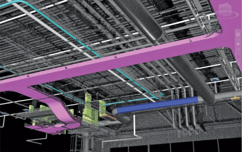
Read MoreVerify 100% of Construction in Fraction of the Time and in 3D
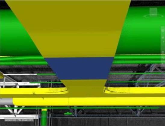
Verify 100% of Construction in Fraction of the Time and in 3D See how this manufacturing plant owner found out exactly where and how much their final construction differed from their design plan. Advances in 3D scanning technology and data analysis software have set a new standard in intelligence for facility owners, architects, engineers and contractors. We…
Read More