Blog
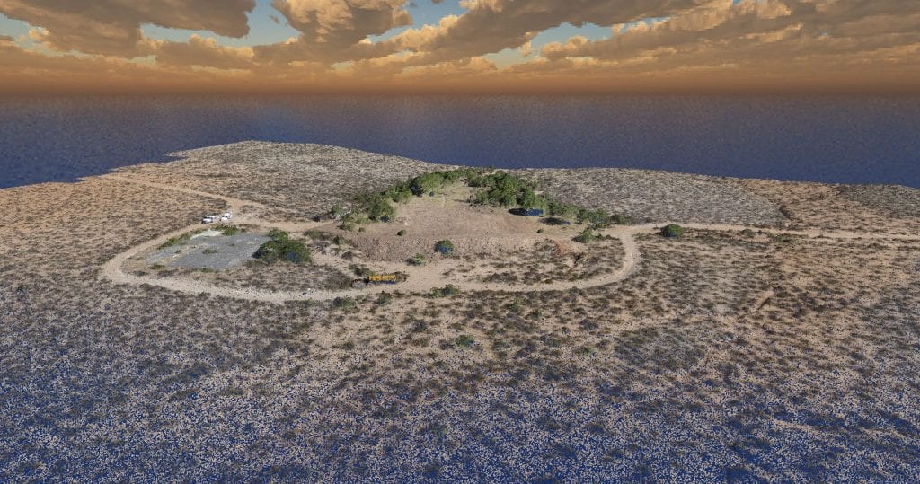
Darling Geomatics Wins Contract to Provide High Tech Forensic Assessments Using Drones and LiDAR
Darling Geomatics Wins Contract to Provide High Tech Forensic Assessments Using Drones and LiDAR We have been selected by a national forensics company to provide our drone survey and LiDAR scanning expertise to produce digital maps and models used in exhibits for the accident and criminal investigations throughout the southwest US for five years. “The 3D…
Read More3D Scanning of Underground Infrastructure
3D scanning by Darling Geomatics provides a precise digital twin of service tunnels, underground utility corridors, shafts, and other subsurface infrastructure used for mapping, planning, clash detection, change detection and safety inspections
Read MoreUAV Photogrammetry: Precision Surveying, Mapping, and 3D Modeling
UAV photogrammetry uses the principles of triangulation to turn 2D photographic images taken by a pilotless aircraft into precise, 3D representations, such as maps and models.
Read MoreDrone Surveys in Arizona and Beyond Provide Invaluable Data
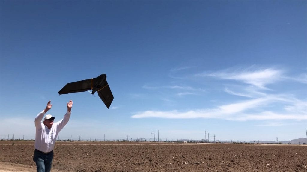
In Arizona and throughout the United States, drone surveys provide revolutionary applications for planning, mapping, monitoring, and imaging on a limitless variety of projects. Considering the relatively recent advent of drone technology, the advances in their capabilities are remarkable. Only since…
Read MoreDigital Transformation of Energy Infrastructure Projects
The transformation to 3D data assists engineers, architects, and facilities managers at nearly every stage of a project by simplifying design workflow.
Read MoreMary Darling Interviewed on Tucson Means Business Podcast

Mary Darling Interviewed on Tucson Means Business Podcast Listen to this Tucson Means Business interview with Mary Darling, CEO and Principal Owner of Darling Geomatics. You’ll learn about her background, starting the company, leading a global, high tech surveying company, and about some of their most interesting and challenging projects. Stay informed Sign up for…
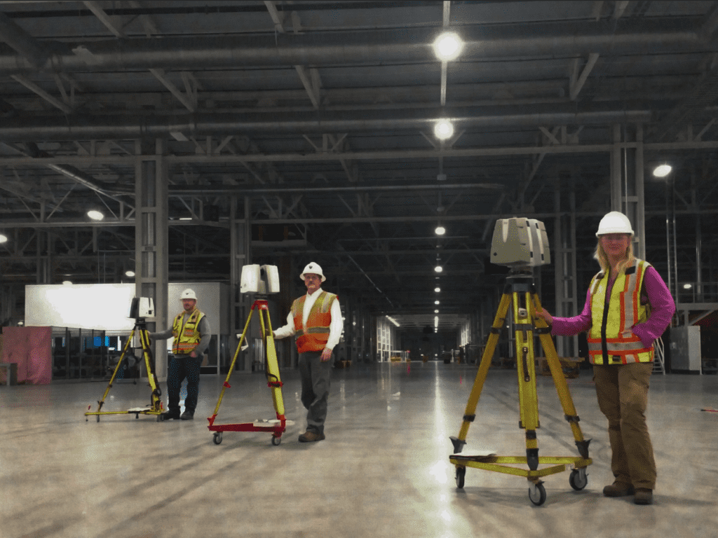
Read MoreNew Best Practice: Virtual Collaboration with Digital Twins
Our 3D scanning services with true color, digital reality data enable projects to advance by keeping teams productive when employees, clients, and stakeholders are working remotely as well as when they are at the office or in the field.
Read MoreImportant Notice From Darling Geomatics
During this time of uncertainty, we at Darling want to assure our customers that we are monitoring the current coronavirus situation closely. As a valued customer it is important that you know Darling Geomatics is open for business.
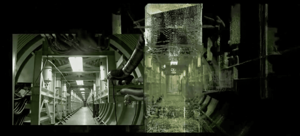
Read More3D Mine Mapping: Complete Surface to Subsurface Digital Twin
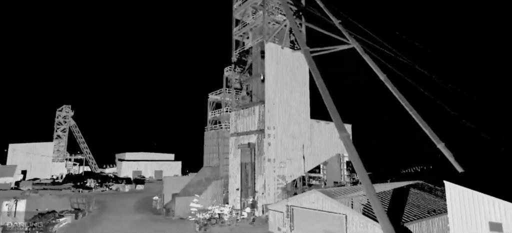
3D Mine Mapping: Complete Surface to Subsurface Digital Twin Watch our new video of 3D mine scanning and mine mapping, starting with an aerial view of the headframe, down the 1,700 foot vertical shaft and through 3 miles of underground workings. The result is a complete georeferenced data set for a digital twin of the…
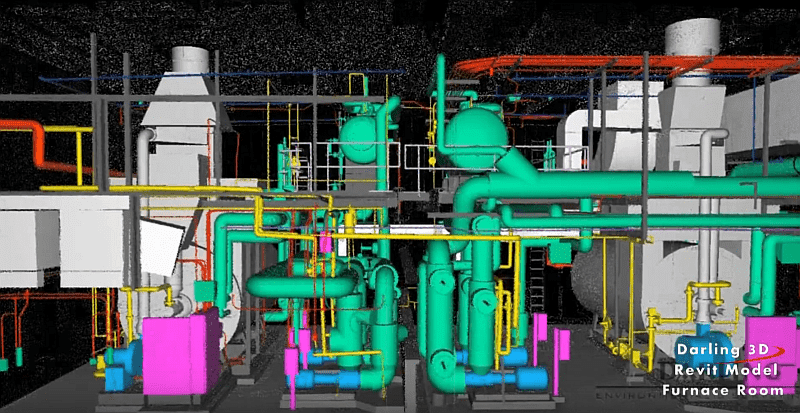
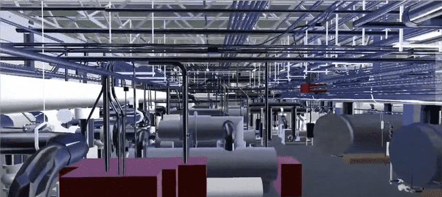
Read MoreSmart Engineering: Digital Twins Before Upgrades
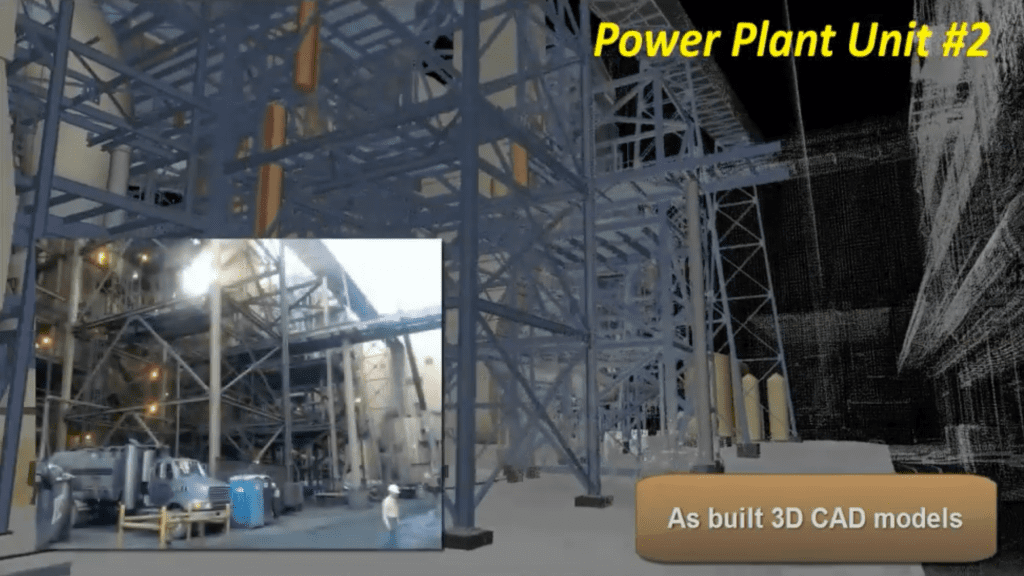
Smart Engineering: Digital Twins Before Upgrades 3D models of as-builts help power industry engineers modify and upgrade assets. Our 3D scanning services are safe, fast and accurate to produce digital twins of power plants, substations and other assets before upgrading, and to provide construction verification to spot check work as it progresses. Power companies trust…
Read More